Soldat Island
Soldat Island (The name as it would appear in a gazetteer)
Soldat Island (The name as it would appear on a map)
If this information is incorrect, please e-mail mapping@aad.gov.au
Place ID: 13631
Name ID: 934
Feature type:
Island
Origin
This name originates from Australia.
It is part of the
Australian Antarctic Gazetteer and the SCAR Composite Gazetteer of Antarctica.
Names that other countries have for this feature:
Narrative
An island in the southern part of the entrance to Long Fjord, Vestfold Hills. The region was photographed by USN Operation Highjump (1946-47), ANARE (1954, 1957 and 1958) and the Soviet Antarctic Expedition (1956).
Named For
The island was called Ostrov Soldat (Soldier Island) on Soviet Map R-44-13,14.
Location
Latitude:
68° 31' 20.6" S
-68.52239°
Accurate to 30m
Longitude:
78° 10' 43.3" E
78.17869°
Accurate to 30m
Altitude:
55 m
Accurate to 5m
Images
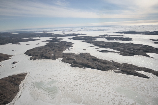
©Nathan Saunders 2009
- Catalogue id
- IA21994
- Caption
- Soldat Island, Vestfold Hills. Taken from helicopter at height of 3000 feet. Looking West.
- Photographer
- Saunders, Nathan
Map
Source
Location Method:
Topographic data
Source Name:
Vestfold Hills Topographic GIS Dataset
Source Identifier:
vest_hills_gis
Source Institution:
Australian Antarctic Division
Source Publisher:
Australian Antarctic Division
Remote sensing:
Not Applicable
Comments
Metadata for coordinates and origin of topographic data.
Approval status
Related information