Fisher Island
Fisher Island (The name as it would appear in a gazetteer)
Fisher Island (The name as it would appear on a map)
If this information is incorrect, please e-mail mapping@aad.gov.au
Place ID: 4632
Name ID: 977
Feature type:
Island
Origin
This name originates from Australia.
It is part of the
Australian Antarctic Gazetteer and the SCAR Composite Gazetteer of Antarctica.
Names that other countries have for this feature:
Narrative
A crescent shaped island west of Broknes Peninsula in the Larsemann Hills. Plotted from air photographs taken by the Lars Christensen Expedition 1936-37 and called Sigdxy by Norwegian cartographers.
Named For
Named after M M Fisher, Surveyor at Mawson in 1957, who carried out the first astrofix in the Larsemann Hills near the western end of this island during the period 12-14 August 1957.
Location
Latitude:
69° 23' 30.0" S
-69.39167°
Accurate to 25m
Longitude:
76° 15' 27.2" E
76.25755°
Accurate to 25m
Altitude:
117 m
Accurate to 10m
Images
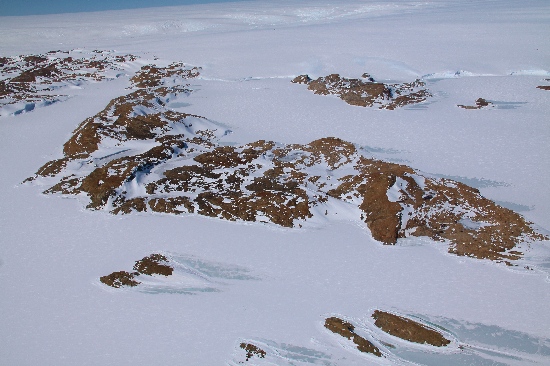
©Adam Christensen 2009
- Catalogue id
- IA21772
- Caption
- Fisher Island, Larsemann Hills. Taken from helicopter at height of 2000 feet. Looking Southwest.
- Photographer
- Christensen, Adam
Map
Source
Source Name:
Larsemann Hills 1:25000 Topographic GIS Dataset
Source Identifier:
Lars25K
Source Institution:
Australian Antarctic Division
Source Publisher:
Australian Antarctic Division
Remote sensing:
Not Applicable
Comments
None
Approval status
Date approved:
29-Sep-1988
Related information