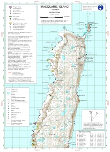
Map 12744: Macquarie Island (Northern Sheet)
Map details
| Map Number | 12744 |
| Title | Macquarie Island (Northern Sheet) |
| Edition | 1 (Out of Date) |
| Next Edition | [Next Edition : 2] |
| Scale | 1 : 50 000 |
| Publication date | September 2001 |
| Publisher |
Australian Antarctic Division (Australia)
|
| Spatial coverage |
(158.7500° -54.4500°)
,
(159.0000° -54.4500°)
,
(159.0000° -54.6667°)
(158.7500° -54.6667°) |
| Projection | Universal Transverse Mercator |
| Physical size | 42 x 29.7 cm A3 |
| Keywords | Macquarie , Island , Topographic , Topographic |
Downloads
This is a digital map available for downloading.
Map Lists
No maps lists available.
Additional Information
| Horizontal datum | WGS84 |
| Vertical datum | Mean Sea Level |
| Nomenclature | Nomenclature Board of Tasmania |
Preview