Map 12916: Macquarie Island Vegetation, Structure & Drainage - Northern Sheet
Map details
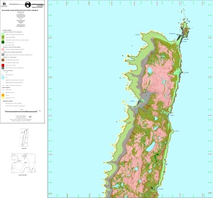
| Map Number | 12916 |
| Title | Macquarie Island Vegetation, Structure & Drainage - Northern Sheet |
| Edition | 2 |
| Previous edition | [Previous edition : 1] |
| Scale | 1 : 25 000 |
| Publication date | May 2001 |
| Publisher |
Australian Antarctic Division (Australia)
Macquarie University (Australia) |
| Spatial coverage |
(158.7500° -54.4660°)
,
(158.9830° -54.4660°)
,
(158.9830° -54.6330°)
(158.7500° -54.6330°) |
| Projection | Universal Transverse Mercator |
| Physical size | 88.5 x 94.1 cm |
| Notes | The only update in this edition is the inclusion of contour data in the map. |
| Keywords | Macquarie , Vegetation , Structure , Drainage , Flora |
Downloads
This is a digital map available for downloading.
- A LZW compressed TIFF
- A print file (PDF)
- Related metadata for Macquarie Island Vegetation and Drainage Structure Data Set.
Map Lists
This map belongs to the following lists. Use the link on the list to see all maps belonging to that list
Additional Information
| Horizontal datum | WGS84 |
| Vertical datum | Mean sea level |
Preview