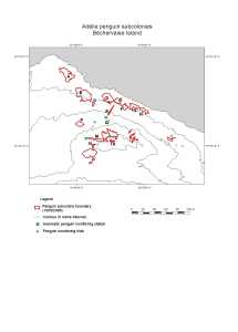
Map 13042: Adelie penguin subcolonies, Bechervaise Island
Map details
| Map Number | 13042 |
| Title | Adelie penguin subcolonies, Bechervaise Island |
| Edition | 1 |
| Scale | 1 : 2000 |
| Publication date | June 2003 |
| Publisher | - |
| Spatial coverage |
( 62.8092° -67.5858°)
,
( 62.8167° -67.5858°)
,
( 62.8167° -67.5881°)
( 62.8092° -67.5881°) |
| Projection | Universal Transverse Mercator |
| Physical size | 11.7 x 15.3 cm |
| Notes | Adapted from a map produced by Lisa Meyer (Australian Antarctic Division), July 2000 |
| Keywords | Adelie Penguin Subcolonies , Bechervaise Island |
Downloads
This is a digital map available for downloading.
Map Lists
This map belongs to the following lists. Use the link on the list to see all maps belonging to that list
Additional Information
| Horizontal datum | WGS84 |
Preview