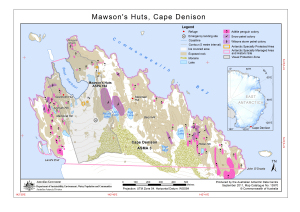
Map 13970: Mawson' Huts, Cape Denison
Map details
| Map Number | 13970 |
| Title | Mawson' Huts, Cape Denison |
| Edition | 1 |
| Scale | 1 : 8000 |
| Publication date | September 2011 |
| Publisher | - |
| Spatial coverage |
(142.6500° -67.0030°)
,
(142.6970° -67.0030°)
,
(142.6970° -67.0140°)
(142.6500° -67.0140°) |
| Projection | Universal Transverse Mercator |
| Physical size | 21 x 29.7 cm A4 |
| Keywords | - |
Downloads
This is a digital map available for downloading.
Map Lists
This map belongs to the following lists. Use the link on the list to see all maps belonging to that list
- Cape Denison / Commonwealth Bay
- Antarctic Specially Protected Areas and Antarctic Specially Managed Areas maps
Additional Information
| Horizontal datum | WGS84 |
| Vertical datum | Mean sea level |
| Nomenclature | Australian Antarctic Names Gazetteer |
Preview