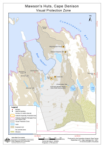
Map 13971: Mawson's Huts, Cape Denison, Visual Protection Zone
Map details
| Map Number | 13971 |
| Title | Mawson's Huts, Cape Denison, Visual Protection Zone |
| Edition | 1 |
| Scale | 1 : 4500 |
| Publication date | September 2011 |
| Publisher | - |
| Spatial coverage |
(142.6506° -67.0036°)
,
(142.6908° -67.0036°)
,
(142.6908° -67.0131°)
(142.6506° -67.0131°) |
| Projection | Universal Transverse Mercator |
| Physical size | 24.5 x 17.5 cm |
| Keywords | Mawson's Huts , Cape Denison , Commonwealth Bay , George V Land , East Antarctica |
Downloads
This is a digital map available for downloading.
Map Lists
This map belongs to the following lists. Use the link on the list to see all maps belonging to that list
- Cape Denison / Commonwealth Bay
- Antarctic Specially Protected Areas and Antarctic Specially Managed Areas maps
Additional Information
| Horizontal datum | WGS84 |
| Vertical datum | Mean Sea Level |
Preview