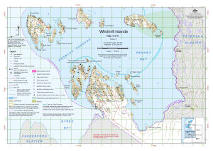
Map 14112: Windmill Islands : Map 3 of 5
Map details
| Map Number | 14112 |
| Title | Windmill Islands : Map 3 of 5 |
| Edition | 6 (Out of Date) |
| Previous edition | [Previous edition : 5] |
| Next Edition | [Next Edition : 7] |
| Scale | 1 : 50 000 |
| Publication date | August 2012 |
| Publisher |
Australian Antarctic Division (Australia)
|
| Spatial coverage |
(110.3433° -66.3956°)
,
(110.7811° -66.3956°)
,
(110.7811° -66.5153°)
(110.3433° -66.5153°) |
| Projection | Universal Transverse Mercator |
| Physical size | 29.7 x 42 cm A3 |
| Keywords | Browning Peninsula , Holl Island , O'connor Island , Werlein Island , Ford Island , Cloyd Island , Herring Island , Bousquet Island , Peterson Island , Motherway Island , Wilson Island , Teigan Island , Bosner Island , Boffa Island , Penney Bay , Eyres Bay , Peterson Glacier , Knowles Passage , Sea Ice Travel Boundary , Station Operational Area , Topographic |
Downloads
This is a digital map available for downloading.
Map Lists
No maps lists available.
Additional Information
| Horizontal datum | WGS 84 |
| Vertical datum | Mean sea level |
| Vertical unit | Metres |
| Magnetic variation | Magnetic North is 101 degrees west of True North |
| Nomenclature | Australian Antarctic Gazetteer |
Preview