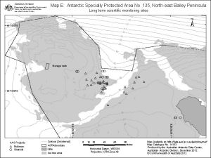
Map 14183: Map E: Antarctic Specially Protected Area No. 135, North-east Bailey Peninsula, Long term scientific monitoring sites
Map details
| Map Number | 14183 |
| Title | Map E: Antarctic Specially Protected Area No. 135, North-east Bailey Peninsula, Long term scientific monitoring sites |
| Edition | 1 (Out of Date) |
| Next Edition | [Next Edition : 2] |
| Scale | 1 : 2000 |
| Publication date | December 2012 |
| Publisher | - |
| Spatial coverage |
(110.5347° -66.2809°)
,
(110.5432° -66.2809°)
,
(110.5432° -66.2830°)
(110.5347° -66.2830°) |
| Projection | Universal Transverse Mercator |
| Physical size | 15 x 20 cm A4 |
| Notes | Map produced for the management plan for Antarctic Specially Protected Area No.135, 2013 |
| Keywords | Windmill Islands , Antarctic Specially Protected Area , ASPA 135 |
Downloads
This is a digital map available for downloading.
Map Lists
No maps lists available.
Additional Information
| Horizontal datum | WGS84 |
| Vertical datum | Mean Sea Level |
| Nomenclature | Australian Antarctic Names Gazetteer |
Preview