Map 14678: Gaussberg
Map details
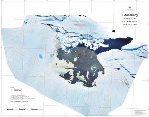
| Map Number | 14678 |
| Title | Gaussberg |
| Edition | 1 |
| Scale | 1 : 5000 |
| Publication date | July 2018 |
| Publisher |
Australian Antarctic Division (Australia)
|
| Spatial coverage |
( 89.1330° -66.7867°)
,
( 89.2446° -66.7867°)
,
( 89.2446° -66.8186°)
( 89.1330° -66.8186°) |
| Projection | Universal Transverse Mercator |
| Physical size | 77 x 99 cm |
| Keywords | - |
Downloads
This is a digital map available for downloading.
Map Lists
This map belongs to the following lists. Use the link on the list to see all maps belonging to that list
Additional Information
| Horizontal datum | WGS84 |
| Vertical datum | Mean Sea Level |
| Vertical unit | Metres |
| Nomenclature | Australian Antarctic Gazetteer |
Preview