Map 15297: South Shetland Islands - Maps 1 and 2
Map details
| Map Number | 15297 |
| Title | South Shetland Islands - Maps 1 and 2 |
| Edition | 2 |
| Previous edition | [Previous edition : 1] |
| Scale | 1 : 200 000 |
| Publication date | 2019 |
| Publisher |
British Antarctic Survey (United Kingdom)
|
| Spatial coverage |
( -53.0000° -60.7000°)
,
( -60.0000° -60.7000°)
,
( -60.0000° -62.5833°)
( -53.0000° -62.5833°) |
| Projection | Lambert Conformal Conic |
| Physical size | 100 x 89 cm |
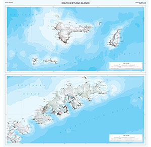
| Notes | This is side A of a double-sided map and contains 2 separate map panels showing Elephant, Clarence, King George, Nelson and Robert islands. Side B (Map number 15298) shows Greenwich, Livingston, Snow, Deception, Smith and Low islands. For more information see https://www.bas.ac.uk/data/our-data/maps/topographic-maps/south-shetland-islands/ |
| Reference | BAS (Misc) 14A |
| Keywords | Elephant Island , Clarence Island , Gibbs Island , King George Island , Nelson Island , Robert Island |
Downloads
No downloads available.
Map Lists
No maps lists available.
Additional Information
| Horizontal datum | WGS84 |
| Vertical datum | EGM2008 |
| Vertical unit | Metres |
| Nomenclature | UK Antarctic Place-names gazetteer |
Preview