Map 16053: MAP 10: Syowa to Mawson
Map details
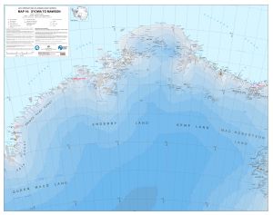
| Map Number | 16053 |
| Title | MAP 10: Syowa to Mawson |
| Edition | 2 |
| Scale | 1 : 1 000 000 |
| Publication date | December 2023 |
| Publisher |
Australian Antarctic Division (Australia)
|
| Spatial coverage |
( 36.6900° -64.7900°)
,
( 66.8200° -64.7900°)
,
( 66.8200° -71.8200°)
( 36.6900° -71.8200°) |
| Projection | Polar Stereographic |
| Physical size | 84.1 x 106.5 cm |
| Reference | No ISBN |
| Alternative title | Air Operations Planning Maps |
| Keywords | Air Operations Planning , Sôya Coast , Soya Coast , Prince Olav Coast , Enderby Land , Kemp Land , Kemp Coast , Mawson Coast |
Downloads
This is a digital map available for downloading.
Map Lists
This map belongs to the following lists. Use the link on the list to see all maps belonging to that list
Additional Information
| Horizontal datum | WGS84 |
| Vertical datum | Mean Sea Level |
| Vertical unit | Feet |
| Nomenclature | All names are from the SCAR Composite Gazetteer of Antarctica |
Preview