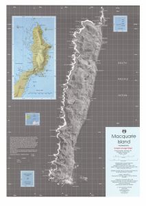
Map 43: Macquarie Island, Tasmania 1991 (Interim Image Map)
Map details
| Map Number | 43 |
| Title | Macquarie Island, Tasmania 1991 (Interim Image Map) |
| Edition | Provisional |
| Scale | 1 : 50 000 |
| Publication date | November 1991 |
| Publisher |
Australian Surveying and Land Information Group, Department of Administrative Services, Canberra (Australia)
Australian Antarctic Division (Australia) |
| Spatial coverage |
(158.7000° -54.4667°)
,
(159.0433° -54.4667°)
,
(159.0433° -54.8000°)
(158.7000° -54.8000°) |
| Projection | Transverse Mercator |
| Physical size | 81.5 x 58.5 cm |
| Notes |
This is a provisional edition. Reprinted November 1992 The map includes notes about the satellite viewing angle causing apparent relief displacement in the image and that the grid shown is a Universal Transverse Mercator grid but users should note that positions obtained may be displaced. |
| Reference | GIU 91/042 |
| Keywords | Interim , Image , Satellite Imagery |
Downloads
This is a hard copy map that has been scanned. See information about obtaining copies of hard copy maps.
- A print file (PDF)
- A zip file that includes, as a PDF, the map overlaid with a correct UTM zone 57 grid and correct lines of latitude and longitude
- A LZW compressed TIFF
- National Library of Australia Bib ID 771928 (External site)
Map Lists
No maps lists available.
Additional Information
| Horizontal datum | ANS |
| Nomenclature | Australian Antarctic Gazetteer |
Preview