Map 5449: Map of Antarctica (Sheet 2 of 9)
Map details
| Map Number | 5449 |
| Title | Map of Antarctica (Sheet 2 of 9) |
| Edition | 2 (Out of Date) |
| Previous edition | [Previous edition : 1] |
| Next Edition | [Next Edition : 3] |
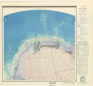
| Scale | 1 : 3 000 000 |
| Publication date | 1968 |
| Publisher |
Ministry of Merchant Fleet of the U.S.S.R. (Russia)
|
| Spatial coverage |
( -20.0000° -63.0000°)
,
( 20.0000° -63.0000°)
,
( 45.0000° -80.0000°)
( -45.0000° -80.0000°) |
| Projection | Polar Stereographic |
| Physical size | 80.5 x 87 cm |
| Notes | Topographic Map. Map of Antarctica. Multi-coloured map compiled from Soviet and foreign source material, to 1967. Continental relief is shown by heights, and contours at 500m intervals; sub-marine relief by soundings and isobaths at 1000m intervals. |
| Alternative title | Karta Antarktidy |
| Keywords | Topographic |
Downloads
No downloads available.
This is a hard copy map. See information about obtaining copies of hard copy maps.
Map Lists
No maps lists available.
Additional Information
Preview