Antarctic Maps
Large scale maps covering scales below 1:100 000
-
that cover
| 60° 00' 00.0" S to 75° 00' 00.0" S |
| 80° 00' 00.0" W to 45° 00' 00.0" W |
For additional maps, see the Mapping for the Map Catalogue.
Use the link on the Map No or the preview if it exists to see full details.
| Map No | Map Title | Year | Scale | Preview |
|---|---|---|---|---|
| 14368 | "Church Point" Area | 1948 | 1 : 10 000 | |
| 13230 | Ablation Valley, Alexander Island | 2005 | 1 : 75 000 | |
| 5869 | Adelaide Anchorage | 1984 | 1 : 30 000 | |
| 361 | Adelaide Island : Southwestern approaches | 1995 | 1 : 75 000 | |
| 5512 | Adelaide Island : Southwestern approaches | 1983 | 1 : 75 000 | |
| 14389 | Admiralty Bay, King George Island, South Shetland Islands | 1954 | 1 : 50 000 | |
| 14421 | Admiralty Bay, King George Island, South Shetland Islands | 1986 | 1 : c33 330 | |
| 5573 | Admiralty Bay: Visca Anchorage | 1968 | 1 : 25 000 | |
| 3343 | Alexander Island | 1991 | 1 : 25 000 | |
| 14442 | Alexander Island | 1990 | 1 : 25 000 | |
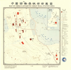
| 14084 | Antarctic Great Wall Station of China | 2005 | 1 : 1000 | |
| 14085 | Antarctic Great Wall Station of China | 2005 | 1 : 1000 | |
| 14086 | Antarctic Great Wall Station of China | 2005 | 1 : 2000 | |
| 14427 | Approaches to Adelaide, Graham Land | 1983 | 1 : c56 500 | |
| 5807 | Approaches to Arthur Harbour | 1978 | 1 : 50 000 | |
| 5872 | Approaches to Prospect Point | 1984 | 1 : 50 000 | |
| 5867 | Argentine Islands | 1984 | 1 : 15 000 | |
| 14377 | Argentine Islands, Graham Land | 1996 | 1 : c26 000 | |
| 14433 | Arthur Harbour, Anvers Island | 1988 | 1 : c25 000 | |
| 14403 | Arthur Harbour, Anvers Island, Palmer Archipelago | 1957 | 1 : 10 000 | |
| 2082 | Bahia Almirantazgo | 1961 | 1 : 40 000 | |
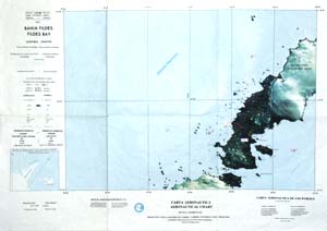
| 13077 | Bahia Fildes, Carta Aeronautica | 1993 | 1 : 50 000 |
 |
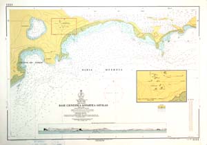
| 13089 | Base Cientific Antartica Artigas | 1991 | 1 : 4000 |
 |
| 12823 | Base General San Martin Baie Marguerite Luftbildkarte |
1999 | 1 : 50 000 | |
| 3051 | Base Juan Carlos 1 / Islas Shetland del sur Isla Livingston / de Punta Polaca a Punta Larisa | 1988 | 1 : 5000 | |
| 5443 | Bellingshausen. King George Island (Waterloo) | 1972 | 1 : 3000 |
 |
| 5027 | Biscoe Islands | 1964 | 1 : 30 000 | |
| 14398 | Booth Island area, Graham Land | 1959 | 1 : 28 000 | |
| 14423 | Bragg Islands, Crystal Sound, Graham Land | 1960 | 1 : c12 000 | |
| 5504 | British Antarctic Survey Base: Rothera, Marguerite Bay | 1983 | 1 : 25 000 | |
| 3078 | British Antarctic Territory - Joubin Islands | 1974 | 1 : 25 000 | |
| 3086 | British Antarctic Territory - South Orkney Islands - Signy Island | 1974 | 1 : 10 000 | |
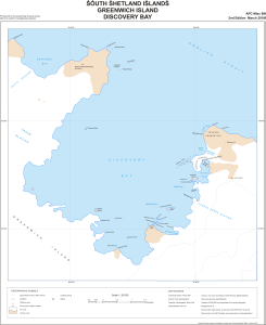
| 3115 | British Antarctic Territory - South Shetland Islands - Discovery Bay - Greenwich Island | 1971 | 1 : 12 500 | |
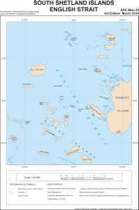
| 3100 | British Antarctic Territory - South Shetland Islands - English Strait | 1971 | 1 : 30 000 | |
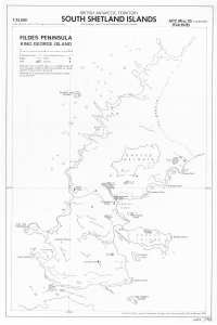
| 13066 | British Antarctic Territory : South Shetland Islands - Fildes Peninsula, King George Island | 1978 | 1 : 25 000 |
 |
| 5689 | British Antarctic Territory, Anvers Island, Arthur Harbour | 1963 | 1 : 10 000 | |
| 5693 | British Antarctic Territory, Anvers Island, South Coast: East Sheet | 1965 | 1 : 25 000 | |
| 5694 | British Antarctic Territory, Anvers Island, South Coast: West Sheet | 1965 | 1 : 25 000 | |
| 5690 | British Antarctic Territory, Argentine Islands with Anagram Islands | 1964 | 1 : 10 000 | |
| 5688 | British Antarctic Territory, South Orkney Islands, Signy Island | 1975 | 1 : 10 000 | |
| 3234 | British Antarctic Territory-Adelaide-Rothera Point | 1980 | 1 : 25 000 | |
| 3307 | British Antarctic Territory-Graham Land | 1988 | 1 : 25 000 | |
| 3246 | British Antarctic Territory-South Orkney Islands | 1982 | 1 : 10 000 | |
| 5194 | Caletas en Bahia Fildes: Caleta Potter, Caleta Ardley, Caleta Marian | 1980 | 1 : 10 000 | |
| 2085 | Caletas en el Territorio Antartico Chileno | 1958 | 1 : 6000 | |
| 3385 | Camp Point to Red Rock Ridge / Graham Land | 1971 | 1 : 50 000 | |
| 14439 | Cape Legopil, Graham Land | 1982 | 1 : c26 200 | |
| 5866 | Cape Legoupil | 1984 | 1 : 15 000 | |
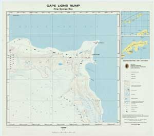
| 2627 | Cape Lions Rump / King George Bay | 1988 | 1 : 5000 |
 |
| 10325 | Casey Station Buildings and Structures | 1998 | 1 : 2000 |
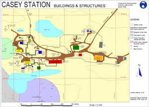 |
| 12822 | Cierva Point Antarktische Halbinsel |
1997 | 1 : 7500 | |
| 13228 | Coal Nunatak, Alexander Island | 2005 | 1 : 10 000 | |
| 13226 | Corner Cliffs / Citadel Bastion | 2005 | 1 : 25 000 | |
| 13272 | Deception Island | 1994 | 1 : 25 000 | |
| 5803 | Deception Island | 1972 | 1 : 50 000 | |
| 5980 | Deception Island | 1968 | 1 : 23 150 | |
| 3336 | Deception Island, South Shetland Islands | 1991 | 1 : 50 000 | |
| 353 | Deception Island, South Shetland Islands | 1987 | 1 : 50 000 | |
| 14378 | Deception Island, South Shetland Islands | 1991 | 1 : 50 000 | |
| 5576 | Desolation Island | 1968 | 1 : 50 000 | |
| 5862 | Desolation Island | 1965 | 1 : 50 000 | |
| 14396 | Desolation Island, Blythe Bay, Livingston Island, South Shetland Islands | 1954 | 1 : 25 000 | |
| 14380 | Dion Islands, Marguerite Bay, Graham Land | 1959 | 1 : 10 000 | |
| 14397 | Discovery Bay and Yankee Harbour, Greenwich Island, South Shetland Islands | 1954 | 1 : 29 200 | |
| 14431 | Discovery Bay, Greenwich Island, South Shetland Islands | 1971 | 1 : c12 500 | |
| 14382 | Easternmost of the Henkes Islets off the south coast of Adelaide Island | 1955 | 1 : 10 000 | |
| 14432 | English Strait, South Shetland Islands | 1977 | 1 : c30 000 | |
| 5193 | Esterecho Nelson | 1978 | 1 : 40 000 | |
| 2084 | Estrecho Ingles y Paso Lautaro | 1963 | 1 : 40 000 | |
| 5695 | Falkland Islands Dependencies, Graham Land - Hope Bay | 1960 | 1 : 25 000 | |
| 5696 | Falkland Islands Dependencies, Graham Land : Horsehoe Island | 1960 | 1 : 25 000 |
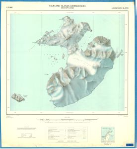 |
| 8269 | Falkland Islands Dependencies, South Orkney Islands, Signy Island | 1967 | 1 : 12 500 | |
| 8284 | Falkland Islands Dependencies, South Shetland Islands, Deception Island, Geology | 1961 | 1 : 25 000 | |
| 5692 | Falkland Islands Dependencies, South Shetland Islands. Deception Island | 1960 | 1 : 25 000 | |
| 14385 | Faure Islets, Marguerite Bay, Graham Land | 1955 | 1 : 50 000 | |
| 8438 | Fig. 2. Simplified geological sketch map of Byers Peninsula | 1980 | 1 : 50 000 | |
| 8417 | Fig. 3. Geological sketch map of Carse Point | 1975 | 1 : 10 000 | |
| 8434 | Fig. 3. Geological sketch map of Horseshoe and Lagotellerie Islands | 1983 | 1 : 25 000 | |
| 2067 | Fildes Peninsula, King George Island | 1991 | 1 : 10 000 |
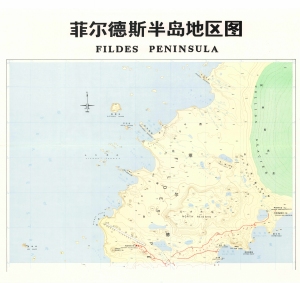 |
| 2068 | Fildes Peninsula, King George Island | 1 : 10 000 |
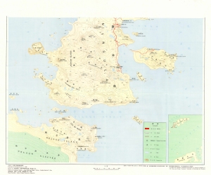 |
|
| 14107 | Fildes Peninsula, King George Island | 2005 | 1 : 10 000 | |
| 14108 | Fildes Peninsula, King George Island | 2005 | 1 : 20 000 | |
| 14436 | Fildes Peninsula, King George Island, South Shetland Islands | 1978 | 1 : 25 000 | |
| 5806 | Flandres Bay and Approaches | 1967 | 1 : 50 000 | |
| 14448 | Fossil Bluff | 1999 | 1 : 12 500 | |
| 8135 | Geologic Map of Seymour Island | 1 : 20 000 | ||
| 13273 | Geological map of Deception Island | 2000 | 1 : 25 000 | |
| 13274 | Geological map of Deception Island | 2000 | 1 : 25 000 | |
| 8266 | Geological map of King George Island | 1965 | 1 : 25 000 | |
| 8357 | Geological map of the Fildes Peninsula | 1972 | 1 : 20 000 | |
| 2224 | Geological Map of the Fildes Peninsula | 1986 | 1 : 20 000 | |
| 8170 | Geomorphological map of Byers Peninsula, Livingston Island | 1996 | 1 : 25 000 | |
| 3412 | Geomorphological map of Byers Peninsula, Livingston Island | 1996 | 1 : 25 000 | |
| 8360 | Geomorphology of the Ablation Point massif, Alexander Island | 1983 | 1 : 50 000 | |
| 5805 | Gerlache Strait | 1967 | 1 : 50 000 | |
| 5580 | Gerlache Strait: Approaches to Danco Island | 1973 | 1 : 50 000 | |
| 14375 | Goudier Islet, Port Lockroy | 1950 | 1 : 1200 | |
| 5581 | Graham Coast: Approaches to Prospect Point | 1973 | 1 : 50 000 | |
| 5579 | Graham Coast: Argentine Islands | 1973 | 1 : 15 000 | |
| 3354 | Graham Land | 1994 | 1 : 25 000 | |
| 2069 | Great Wall Station, Fildes Peninsula | 1987 | 1 : 1000 |
 |
| 5571 | Greenwich Island: Discovery Bay | 1968 | 1 : 25 000 | |
| 5569 | Greenwich Island: Yankee Harbour | 1968 | 1 : 15 000 | |
| 5857 | Greenwich Island: Yankee Harbour | 1965 | 1 : 15 000 | |
| 5856 | Half Moon Island | 1965 | 1 : 15 000 | |
| 5570 | Half Moon Island | 1968 | 1 : 25 000 | |
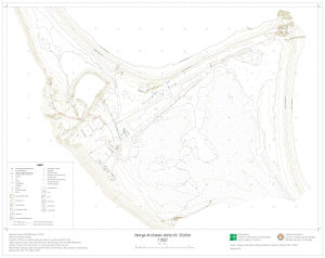
| 14496 | Henryk Arctowski Antarctic Station | 2015 | 1 : 500 |
 |
| 5868 | Hope Bay | 1984 | 1 : 30 000 | |
| 14366 | Hope Bay, Trinity Peninsula, Graham Land | 1957 | 1 : 10 000 | |
| 14404 | Hope Bay, Trinity Peninsula, Graham Land | 1988 | 1 : 25 000 | |
| 14405 | Horseshoe Island, Marguerite Bay, Graham Land | 1959 | 1 : 25 000 | |
| 14393 | Inverleith Harbour area, Anvers Island, Palmer Archipelago | 1980 | 1 : 26 000 | |
| 13859 | Isla Nelson - Punta Armonia Shetland Del Sur |
1986 | 1 : 5000 |
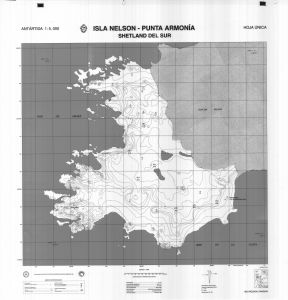 |
| 13088 | Isla Rey Jorge, Peninsula Fildes Islas Shetland Del Sur |
1997 | 1 : 10 000 |
 |
| 14371 | Island SE of The Naze | 1948 | 1 : 10 000 | |
| 5021 | Islas Shetland del Sur: Isla 25 de Mayo: Bahia Guardia Nacional | 1957 | 1 : 25 000 | |
| 2619 | Johnsons Dock Area - South Bay - Livingston Island | 1988 | 1 : 5000 | |
| 14434 | Joubin Islands | 1974 | 1 : c25 000 | |
| 13005 | King George Island : Site of Special Scientific Interest No. 8 (SSSI - 8) | 2002 | 1 : 12 500 |
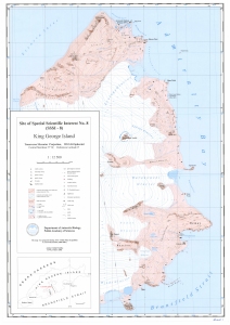 |
| 5861 | King George Island: Admiralty Bay and King George Bay | 1965 | 1 : 50 000 | |
| 5572 | King George Island: Marion Cove and Potter Cove | 1968 | 1 : 25 000 | |
| 5873 | Lystad Bay | 1984 | 1 : 50 000 | |
| 2057 | Marambio Island | 1990 | 1 : 25 000 | |
| 5503 | Marguerite Bay: Debenham Islands | 1 : 25 000 | ||
| 5510 | Marguerite Bay: Neny Island | 1 : 50 000 | ||
| 14402 | Martin Islands, Biscoe Islands, West Graham Land | 1957 | 1 : 20 000 | |
| 5870 | Melchior Islands | 1984 | 1 : 35 000 | |
| 5013 | Melchior Islands | 1957 | 1 : 20 000 | |
| 14392 | Melchior Islands, Dallmann Bay, Palmer Archipelago | 1959 | 1 : 20 000 | |
| 14422 | Nansen Island area, Wilhelmina Bay, Danco Coast | 1961 | 1 : 25 000 | |
| 5574 | Nelson Island: Harmony Cove | 1968 | 1 : 25 000 | |
| 5858 | Nelson Island: Harmony Cove | 1965 | 1 : 20 000 | |
| 5871 | Nevy Island | 1984 | 1 : 50 000 | |
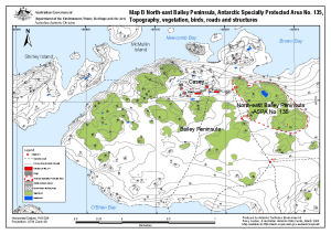
| 13512 | North-east Bailey Peninsula, Antarctic Specially Protected Area No. 135 : Topography, vegetation, birds, roads and structures (Map B) | 2008 | 1 : 12 000 |
 |
| 3712 | Northern Base, Argentine Islands : British Graham Land Expedition. February 1935 - February 1936 | 1938 | 1 : 15 000 |
 |
| 12828 | Orthophotokarte Fildeshalbinsel (Koenig-Georg-Insel, Antarktis) | 1988 | 1 : 20 000 | |
| 5507 | Palmer Archipelago: Melchior Islands | 1 : 35 000 | ||
| 5502 | Palmer Archipelago: Port Lockroy | 1 : 10 000 | ||
| 14394 | Paradise Harbour area, Gerlache Strait, Graham Land | 1957 | 1 : 50 000 | |
| 5026 | Peltier and Neumayer Channels | 1964 | 1 : 30 000 | |
| 3050 | Peninsula Byers / Isla Livingston | 1992 | 1 : 25 000 | |
| 3413 | Peninsula Byers / Isla Livingston (accompanies BAS GEOMAP Sheet 5-A) | 1992 | 1 : 25 000 | |
| 14399 | Petermann Island area, Graham Land | 1959 | 1 : 8130 | |
| 13839 | Plans on Palmer Peninsula and Adjacent Islands | 1963 | 1 : 35 000 | |
| 5865 | Port Lockroy | 1984 | 1 : 10 000 | |
| 14372 | Port Lockroy, Wiencke Island, Palmer Archipelago | 1960 | 1 : 10 000 | |
| 2083 | Puerto Covadonga | 1959 | 1 : 10 000 | |
| 2091 | Puertos en el Territorio Antartico Chileno: Archipielago Melchior: Bahia Hope 1:30000, Bahia South 1:30000, Seno Discovery 1:20000, Puertos Angamos y Lockroy 1:10000, Caleto Hackapike 1:10000 | 1955 | 1 : 20 000 | |
| 2095 | Puertos en el Territorio Antartico Chileno: Bahia Neny | 1947 | 1 : 20 000 | |
| 2081 | Puertos en el Territorio Antartico Chileno: Isla Deception. Insets: Bahia Yankee 1:10000, Caleta Balleneros 1:8000 | 1953 | 1 : 50 000 | |
| 5191 | Puertos en el Territorio Antartico Chileno: Isla Greenwich: Bahia Chile: 1:20000, Puerto Soberania 1:10000 | 1951 | 1 : 20 000 | |
| 2097 | Punta Fort Williams / Greenwich Island / Shetland Isles | 1990 | 1 : 5000 | |
| 12843 | Republica de Chile: Isla Rey Jorge-Peninsula Fildes / Islas Shetland del Sur / XII Region de Magallanes Y de la / Antartica Chilena | 1996 | 1 : c10 000 |
 |
| 5575 | Robert Island: English Strait (Northern Entrance) | 1968 | 1 : 30 000 | |
| 3388 | Rothera Point - Wright Peninsula, Adelaide Island Wright Peninsula |
1995 | 1 : 50 000 | |
| 14437 | Rothera Point, Adelaide Island, Graham Land | 1994 | 1 : 25 000 | |
| 3387 | Rothera Point-Wright Peninsula, Adelaide Island Rothera Point |
1995 | 1 : 2000 | |
| 14367 | Seymour and Cockburn Islands | 1948 | 1 : 25 000 | |
| 14443 | Seymour Island | 1991 | 1 : 40 000 | |
| 3346 | Seymour Island | 1991 | 1 : 40 000 | |
| 3624 | Seymour Island and part of Snow Hill Island | 1988 | 1 : 20 000 | |
| 5024 | Shetland Islands | 1957 | 1 : 30 000 | |
| 5030 | Shetland Islands: Nelson, English and MacFarlane | 1957 | 1 : 50 000 | |
| 13234 | Signy Island, South Orkney Islands | 2005 | 1 : 10 000 | |
| 14374 | Signy Island, South Orkney Islands | 1991 | 1 : 10 000 | |
| 14373 | Soundings in area of Stonington Island | 1947 | 1 : 2000 | |
| 14370 | South of C.Lachman on James Ross Island | 1948 | 1 : 10 000 | |
| 3335 | South Orkney Islands | 1991 | 1 : 10 000 | |
| 13235 | South Orkney Islands - Signy Island | 2005 | 1 : 10 000 | |
| 13798 | South Shetland Islands : English Strait | 2010 | 1 : 50 000 |
 |
| 13797 | South Shetland Islands : Greenwich Island, Discovery Bay | 2010 | 1 : 20 000 |
 |
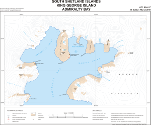
| 13796 | South Shetland Islands : King George Island, Admiralty Bay | 2010 | 1 : 40 000 |
 |
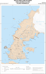
| 13799 | South Shetland Islands : King George Island, Fildes Peninsula | 2010 | 1 : 25 000 |
 |
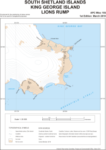
| 13803 | South Shetland Islands : King George Island, Lions Rump | 2010 | 1 : 25 000 |
 |
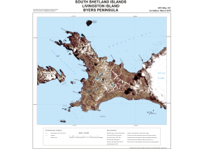
| 13801 | South Shetland Islands : Livingston Island, Byers Peninsula | 2010 | 1 : 50 000 |
 |
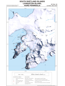
| 13802 | South Shetland Islands : Livingston Island, Hurd Peninsula | 2010 | 1 : 75 000 |
 |
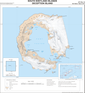
| 13795 | South Shetland Islands: Deception Island | 2010 | 1 : 50 000 |
 |
| 5509 | South Shetland Islands: Deception Island | 1987 | 1 : 50 000 | |
| 13424 | St. Kliment Ohridski Base, Livingston Island | 1996 | 1 : 1000 |
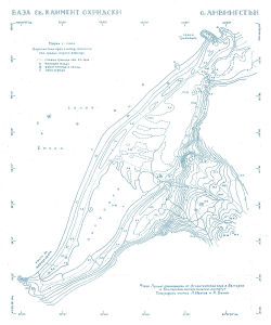 |
| 14383 | Stonington Island area, Marguerite Bay, Graham Land | 1973 | 1 : 50 000 | |
| 14379 | Stonington Island, Marguerite Bay, Graham Land | 1964 | 1 : 2000 | |
| 14384 | Terra Firma Islands, Marguerite Bay, Graham Land | 1959 | 1 : 15 840 | |
| 2092 | Territorio Antartico Chileno | 1951 | 1 : 50 000 | |
| 2080 | Territorio Antartico Chileno: Isla Greenwich Bahia Chile | 1965 | 1 : 10 000 | |
| 14369 | The Naze on James Ross Island | 1948 | 1 : 10 000 | |
| 5006 | Trinidad Peninsula, Antarctica: Esperanza Bay | 1981 | 1 : 10 000 | |
| 5506 | Trinity Peninsula: Hope Bay | 1 : 30 000 | ||
| 13461 | Turret Point, Three Sisters Point and Penguin Island | 2007 | 1 : 12 500 |
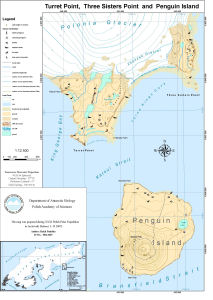 |
| 14449 | Two Step Cliffs | 1999 | 1 : 12 500 | |
| 5804 | Vicinity of Arthur Harbour | 1977 | 1 : 50 000 | |
| 5864 | Waterboat Point | 1984 | 1 : 8000 | |
| 13462 | Western shore of Admiralty Bay, King George Island : orthophoto map | 2007 | 1 : 10 000 |
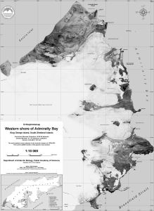 |
| 13800 | Williams Point: Livingston Island | 1999 | 1 : 83 333 |
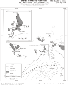 |