Antarctic Maps
Large scale maps covering scales below 1:100 000
-
that cover
| 62° 26' 00.0" S to 62° 46' 00.0" S |
| 61° 17' 00.0" W to 59° 43' 00.0" W |
For additional maps, see the Mapping for the Map Catalogue.
Use the link on the Map No or the preview if it exists to see full details.
| Map No | Map Title | Year | Scale | Preview |
|---|---|---|---|---|
| 3051 | Base Juan Carlos 1 / Islas Shetland del sur Isla Livingston / de Punta Polaca a Punta Larisa | 1988 | 1 : 5000 | |
| 3115 | British Antarctic Territory - South Shetland Islands - Discovery Bay - Greenwich Island | 1971 | 1 : 12 500 | |
| 5576 | Desolation Island | 1968 | 1 : 50 000 | |
| 5862 | Desolation Island | 1965 | 1 : 50 000 | |
| 14396 | Desolation Island, Blythe Bay, Livingston Island, South Shetland Islands | 1954 | 1 : 25 000 | |
| 14397 | Discovery Bay and Yankee Harbour, Greenwich Island, South Shetland Islands | 1954 | 1 : 29 200 | |
| 14431 | Discovery Bay, Greenwich Island, South Shetland Islands | 1971 | 1 : c12 500 | |
| 2084 | Estrecho Ingles y Paso Lautaro | 1963 | 1 : 40 000 | |
| 8284 | Falkland Islands Dependencies, South Shetland Islands, Deception Island, Geology | 1961 | 1 : 25 000 | |
| 8438 | Fig. 2. Simplified geological sketch map of Byers Peninsula | 1980 | 1 : 50 000 | |
| 8170 | Geomorphological map of Byers Peninsula, Livingston Island | 1996 | 1 : 25 000 | |
| 3412 | Geomorphological map of Byers Peninsula, Livingston Island | 1996 | 1 : 25 000 | |
| 5571 | Greenwich Island: Discovery Bay | 1968 | 1 : 25 000 | |
| 5857 | Greenwich Island: Yankee Harbour | 1965 | 1 : 15 000 | |
| 5569 | Greenwich Island: Yankee Harbour | 1968 | 1 : 15 000 | |
| 5570 | Half Moon Island | 1968 | 1 : 25 000 | |
| 5856 | Half Moon Island | 1965 | 1 : 15 000 | |
| 2619 | Johnsons Dock Area - South Bay - Livingston Island | 1988 | 1 : 5000 | |
| 13512 | North-east Bailey Peninsula, Antarctic Specially Protected Area No. 135 : Topography, vegetation, birds, roads and structures (Map B) | 2008 | 1 : 12 000 |
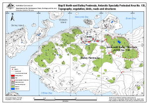 |
| 3050 | Peninsula Byers / Isla Livingston | 1992 | 1 : 25 000 | |
| 3413 | Peninsula Byers / Isla Livingston (accompanies BAS GEOMAP Sheet 5-A) | 1992 | 1 : 25 000 | |
| 5191 | Puertos en el Territorio Antartico Chileno: Isla Greenwich: Bahia Chile: 1:20000, Puerto Soberania 1:10000 | 1951 | 1 : 20 000 | |
| 2097 | Punta Fort Williams / Greenwich Island / Shetland Isles | 1990 | 1 : 5000 | |
| 5030 | Shetland Islands: Nelson, English and MacFarlane | 1957 | 1 : 50 000 | |
| 13797 | South Shetland Islands : Greenwich Island, Discovery Bay | 2010 | 1 : 20 000 |
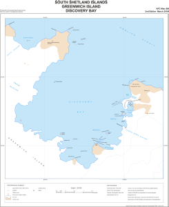 |
| 13801 | South Shetland Islands : Livingston Island, Byers Peninsula | 2010 | 1 : 50 000 |
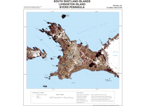 |
| 13802 | South Shetland Islands : Livingston Island, Hurd Peninsula | 2010 | 1 : 75 000 |
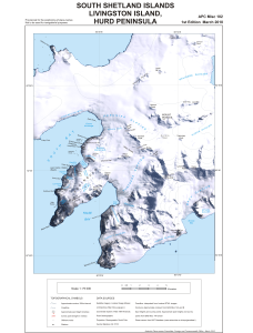 |
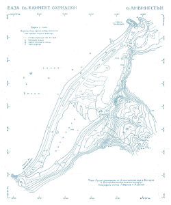
| 13424 | St. Kliment Ohridski Base, Livingston Island | 1996 | 1 : 1000 |
 |
| 2080 | Territorio Antartico Chileno: Isla Greenwich Bahia Chile | 1965 | 1 : 10 000 | |
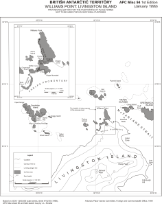
| 13800 | Williams Point: Livingston Island | 1999 | 1 : 83 333 |
 |