Antarctic Maps
Large scale maps covering scales below 1:100 000
-
that cover
| 66° 10' 26.0" S to 66° 17' 50.0" S |
| 110° 22' 05.3" E to 110° 40' 20.1" E |
For additional maps, see the Mapping for the Map Catalogue.
Use the link on the Map No or the preview if it exists to see full details.
| Map No | Map Title | Year | Scale | Preview |
|---|---|---|---|---|
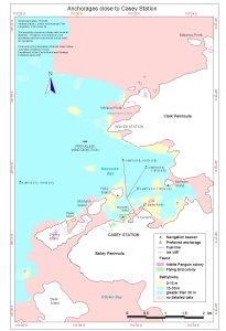
| 12829 | Anchorages close to Casey Station | 2001 | 1 : 30 000 |
 |
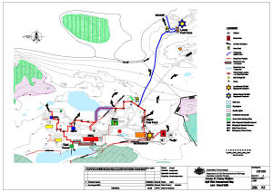
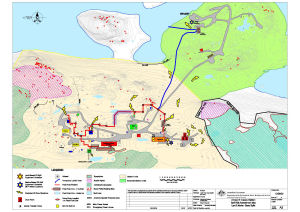
| 14319 | Annex B: Casey Station Spill Risk Assessment Map Land - Based Spills |
2002 | 1 : 2000 |
 |
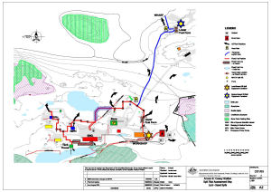
| 14320 | Annex B: Casey Station Spill Risk Assessment Map Land - Based Spills |
2004 | 1 : 2000 |
 |
| 14321 | Annex B: Casey Station Spill Risk Assessment Map Land - Based Spills |
2008 | 1 : 2000 |
 |
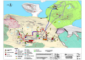
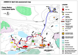
| 14322 | Annex B: Casey Station Spill Risk Assessment Map Land and Marine-Based Spills |
2014 | 1 : 2000 |
 |
| 13702 | Annex B: Casey Station Spill Risk Assessment Map Land and Marine-Based Spills. |
2008 | 1 : 2000 |
 |
| 14318 | Annex B: Spill Risk Assessment Map Casey Station Land - Based Spills |
2001 | 1 : 2000 |
 |
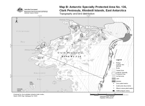
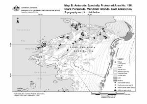
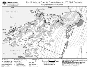
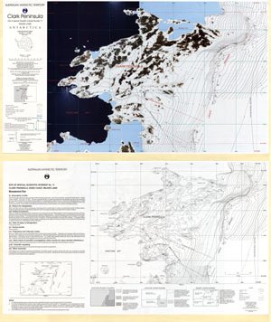
| 13253 | Antarctic Specially Protected Area No. 136 : Map B, Clark Peninsula, Windmill Islands, East Antarctica. Topography and bird distribution. | 2006 | 1 : 30 000 |
 |
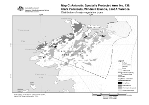
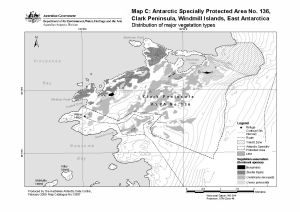
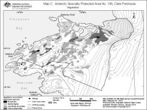
| 13255 | Antarctic Specially Protected Area No. 136 : Map C, Clark Peninsula, Windmill Islands, East Antarctica. Distribution of major vegetation types. | 2006 | 1 : 30 000 |
 |
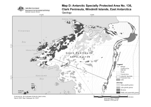
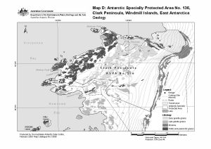
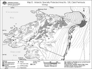
| 13257 | Antarctic Specially Protected Area No. 136 : Map D, Clark Peninsula, Windmill Islands, East Antarctica. Geology | 2006 | 1 : 30 000 |
 |
| 13596 | Antarctic Specially Protected Area No. 136, Clark Peninsula, Windmill Islands, East Antarctica. Map B: Topography and bird distribution. |
2009 | 1 : 30 000 |
 |
| 13598 | Antarctic Specially Protected Area No. 136, Clark Peninsula, Windmill Islands, East Antarctica. Map D: Geology |
2009 | 1 : 30 000 |
 |
| 13597 | Antarctic Specially Protected Area No. 136, Clark Peninsula, Windmill Islands, East Antarctica. Map C:Distribution of major vegetation types. |
2009 | 1 : 30 000 |
 |
| 14271 | Antarctic Specially Protected Area No. 136 Clark Peninsula Map B: Topography and bird distribution |
2014 | 1 : 35 000 |
 |
| 14272 | Antarctic Specially Protected Area No. 136 Clark Peninsula Map C : Vegetation |
2014 | 1 : 35 000 |
 |
| 14273 | Antarctic Specially Protected Area No. 136 Clark Peninsula Map D: Geology |
2014 | 1 : 30 000 |
 |
| 14143 | Approaches to Wilkes Station | 1962 | 1 : 50 000 |
 |
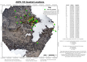
| 14450 | ASPA 135 Quadrat Locations | 2015 | 1 : 400 |
 |
| 14505 | AUS 601 Approaches to Casey | 2015 | 1 : 50 000 |
 |
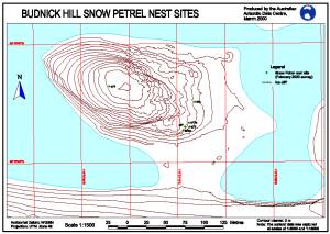
| 12220 | Budnick Hill Snow Petrel Nest Sites | 2000 | 1 : 1500 |
 |
| 14186 | Casey : Antarctica base - Casey wharf detail | 1988 | 1 : 200 |
 |
| 14185 | Casey : Antarctica base - detail engineering survey (Sheet 1 of 9) | 1988 | 1 : 500 |
 |
| 14191 | Casey : Antarctica Base - detail engineering survey : SE portion of base | 1988 | 1 : 1000 |
 |
| 14192 | Casey : Antarctica Base - detail engineering survey : SW portion of base | 1988 | 1 : 1000 |
 |
| 14187 | Casey : Antarctica base - Emergency power house, met enclosure and proposed science building area : detail engineering survey (Sheet 1 of 2) | 1989 | 1 : 200 |
 |
| 14189 | Casey : Antarctica Base - Proposed Helipad Area : detail engineering survey (Sheet 1 of 2) | 1989 | 1 : 200 |
 |
| 14188 | Casey : Antarctica base - proposed science building area : detail engineering survey | 1989 | 1 : 200 |
 |
| 14190 | Casey : Antarctica Base - Proposed Vehicle Shelter and Flammable Liquid Store : detail engineering survey | 1989 | 1 : 200 |
 |
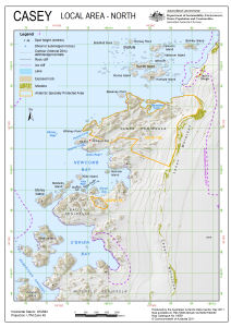
| 14008 | Casey : Local Area North | 2011 | 1 : 53 000 |
 |
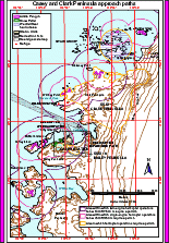
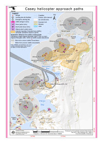
| 12548 | Casey and Clark Peninsula approach paths (Helicopter Operations) | 2000 | 1 : 58 000 |
 |
| 192 | Casey Approaches | 1991 | 1 : 10 000 | |
| 389 | Casey Approaches including enlarged inset of Newcomb Bay | 1992 | 1 : 50 000 | |
| 890 | Casey Area - overlaid with flight paths | 1990 | 1 : 50 000 | |
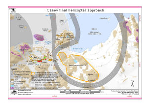
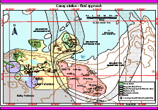
| 14248 | Casey final helicopter approach (Helicopter Operations) | 2013 | 1 : 13 465 |
 |
| 13880 | Casey final helicopter approach (Helicopter Operations) | 2011 | 1 : 10 000 |
 |
| 14540 | Casey final helicopter approach (Helicopter Operations) | 2016 | 1 : 10 000 |
 |
| 14305 | Casey final helicopter approach (Helicopter Operations) | 2014 | 1 : 10 000 |
 |
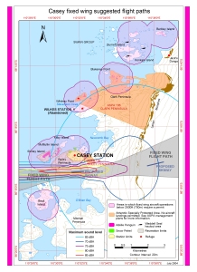
| 13689 | Casey fixed wing suggested flight paths | 2009 | 1 : 55 000 |
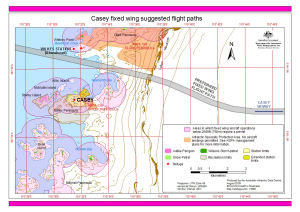 |
| 13930 | Casey fixed wing suggested flight paths | 2012 | 1 : 55 000 |
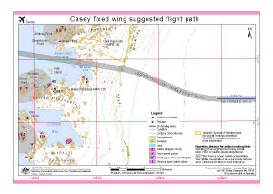 |
| 13024 | Casey fixed wing suggested flight paths | 2003 | 1 : 55 000 |
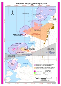 |
| 13085 | Casey fixed wing suggested flight paths and maximum sound levels | 2004 | 1 : 55 000 |
 |
| 13879 | Casey helicopter approach paths (Helicopter Operations) | 2011 | 1 : 60 000 |
 |
| 14247 | Casey Helipads | 2013 | 1 : 1500 |
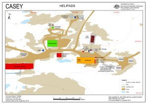 |
| 14566 | Casey Helipads | 2017 | 1 : 1500 |
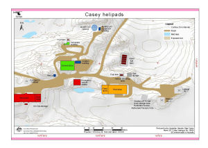 |
| 14600 | Casey Helipads | 2017 | 1 : 1500 |
 |
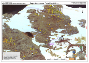
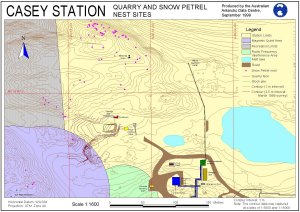
| 13992 | Casey Quarry and Petrel Nest Sites | 2011 | 1 : 1187 |
 |
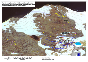
| 13383 | Casey quarry area with surveyed quarry boundary and outer limits set at 1985/86 showing positions of petrel nests current at 2004 and quarry face current at 2000 | 2005 | 1 : c1666 |
 |
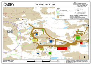
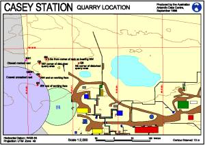
| 13740 | Casey Quarry Location | 2010 | 1 : 2000 |
 |
| 5151 | Casey Radio Installations | 1986 | 1 : 8000 |
 |
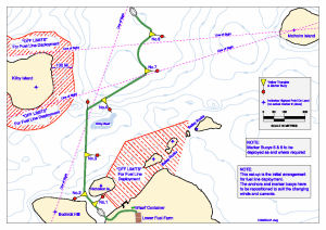
| 13745 | Casey refuelling: initial arrangement for fuel line deployment | 2010 | 1 : 5200 |
 |
| 207 | Casey Station - Approaches | 1991 | 1 : 10 000 | |
| 12552 | Casey station - final approach (Helicopter Operations) | 2000 | 1 : 10 000 |
 |
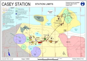
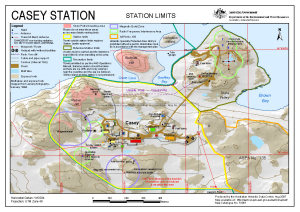
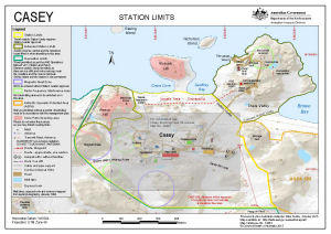
| 12743 | Casey Station - Station Limits | 2001 | 1 : 6000 |
 |
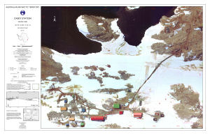
| 12888 | Casey Station : Orthophoto map | 2002 | 1 : 1125 |
 |
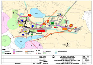
| 14458 | Casey Station 2000 New Season Snow and Existing Ice Buildup New Road Repairs Existing Roads in Need of Crushed Rock |
2000 | 1 : 1000 |
 |
| 198 | Casey Station Approaches | 1993 | 1 : 25 000 | |
| 199 | Casey Station Approaches | 1991 | 1 : 25 000 | |
| 12889 | Casey Station Area : Orthophoto map | 2002 | 1 : 3000 |
 |
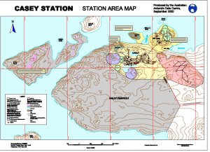
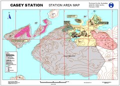
| 12708 | Casey Station Area Map | 2000 | 1 : 3200 |
 |
| 12532 | Casey Station Area Map | 1999 | 1 : 20 000 |
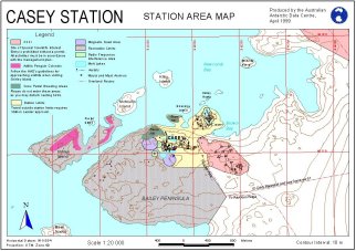 |
| 12533 | Casey Station Area Map | 2000 | 1 : 20 000 |
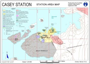 |
| 13049 | Casey Station Area Map | 2003 | 1 : 3200 |
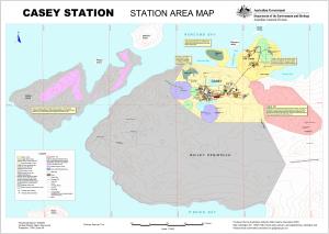 |
| 13021 | Casey Station Area Map | 2003 | 1 : 20 000 |
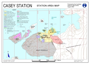 |
| 11112 | Casey Station Area Map | 1999 | 1 : 3200 |
 |
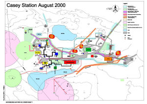
| 14459 | Casey Station August 2000 | 2001 | 1 : 1000 |
 |
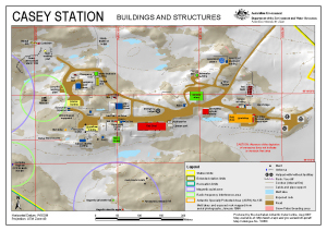
| 10146 | Casey Station Buildings and Structures | 1999 | 1 : 2500 |
 |
| 13064 | Casey Station Buildings and Structures | 2004 | 1 : 2500 |
 |
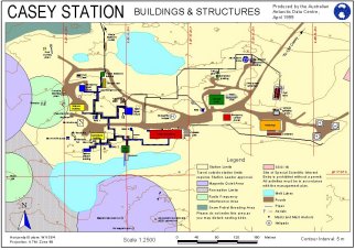
| 12460 | Casey Station Buildings and Structures | 2000 | 1 : 2500 |
 |
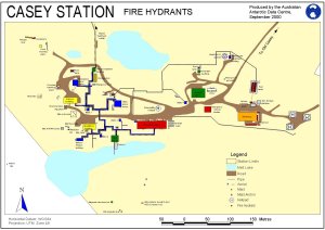
| 12420 | Casey Station Fire Hydrants | 2000 | 1 : 2600 |
 |
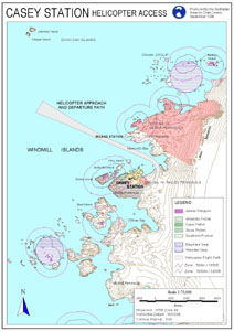
| 12201 | Casey Station Helicopter Access | 1998 | 1 : 75 000 |
 |
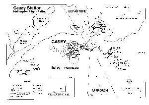
| 12224 | Casey Station Helicopter Flight Paths | 1996 | 1 : 13 200 |
 |
| 5153 | Casey Station Local Area Map | 1996 | 1 : 10 000 |
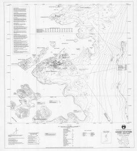 |
| 13131 | Casey Station Local Area Map | 1992 | 1 : 10 000 |
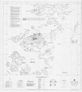 |
| 14058 | Casey Station Local Area Map | 1995 | 1 : 10 000 |
 |
| 12223 | Casey Station Quarry and Snow Petrel Nest Sites | 2000 | 1 : 3000 |
 |
| 11325 | Casey Station Quarry and Snow Petrel Nest Sites | 1999 | 1 : 1600 |
 |
| 12221 | Casey Station Quarry Location | 1998 | 1 : 2000 |
 |
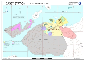
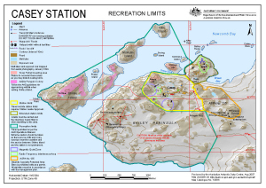
| 12742 | Casey Station Recreation Limits Map | 2001 | 1 : 10 000 |
 |
| 13022 | Casey Station Recreation Limits Map (Out of Date) | 2003 | 1 : 10 000 |
 |
| 11326 | Casey Station Road from the Station to Old Casey | 1999 | 1 : 2800 |
 |
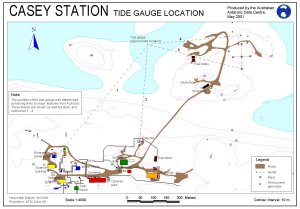
| 12706 | Casey Station Tide Gauge Location | 2001 | 1 : 4000 |
 |
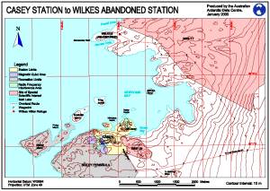
| 12203 | Casey Station to Wilkes Abandoned Station | 2000 | 1 : 25 000 |
 |
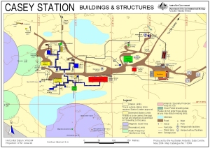
| 13360 | Casey Station: Buildings and Structures | 2007 | 1 : 2500 |
 |
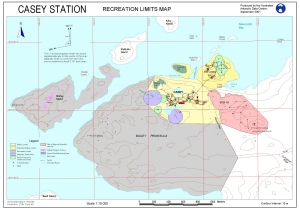
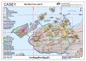
| 13384 | Casey Station: Recreation Limits | 2007 | 1 : 15 500 |
 |
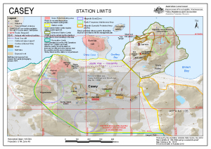
| 13361 | Casey Station: Station Limits | 2007 | 1 : 6000 |
 |
| 14460 | Casey Station New Season and Existing Ice Buildup |
2003 | 1 : 1000 |
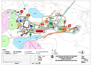 |
| 14462 | Casey Station New Season and Existing Ice Buildup |
2014 | 1 : 1000 |
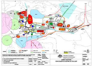 |
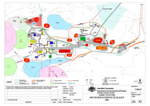
| 14461 | Casey Station New Season and Existing Ice Buildup 2005 |
2005 | 1 : 1000 |
 |
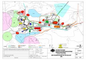
| 13488 | Casey Station New Season and Existing Ice Buildup 2005 |
2005 | 1 : 1000 |
 |
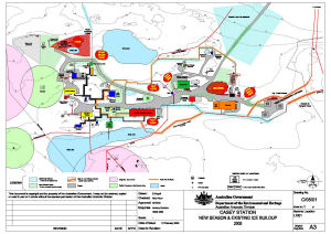
| 13973 | Casey Station New Season and Existing Ice Buildup 2005 |
2008 | 1 : 1000 |
 |
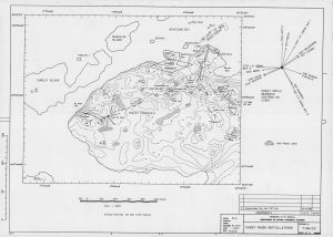
| 5152 | Casey Transmitter Site | 1969 | 1 : 600 |
|
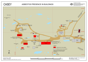
| 13938 | Casey: Asbestos presence in buildings | 2011 | 1 : 1400 |
 |
| 14292 | Casey: Buildings and Structures | 2014 | 1 : 2500 |
 |
| 14483 | Casey: Buildings and Structures | 2015 | 1 : 2500 |
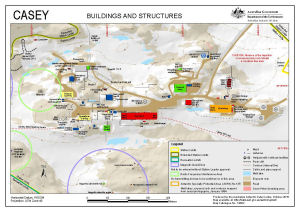 |
| 14596 | Casey: Buildings and Structures | 2017 | 1 : 2500 |
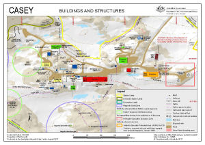 |
| 14532 | Casey: Buildings and Structures | 2016 | 1 : 2500 |
 |
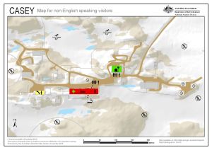
| 14479 | Casey: Critical safety map for non-English speaking visitors | 2015 | 1 : c2200 |
 |
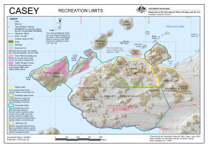
| 14485 | Casey: Recreation Limits | 2015 | 1 : 15 500 |
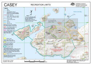 |
| 14534 | Casey: Recreation Limits | 2016 | 1 : 15 500 |
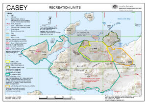 |
| 14598 | Casey: Recreation Limits | 2017 | 1 : 15 500 |
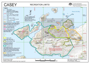 |
| 14295 | Casey: Recreation Limits | 2014 | 1 : 15 500 |
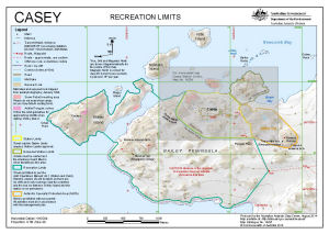 |
| 13917 | Casey: Recreation Limits | 2010 | 1 : 15 500 |
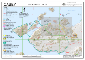 |
| 13510 | Casey: Recreation Limits | 2008 | 1 : 15 500 |
 |
| 13650 | Casey: Recreation Limits | 2009 | 1 : 15 500 |
 |
| 13916 | Casey: Station Limits | 2010 | 1 : 6000 |
 |
| 14294 | Casey: Station Limits | 2014 | 1 : 6000 |
 |
| 14597 | Casey: Station Limits | 2017 | 1 : 6000 |
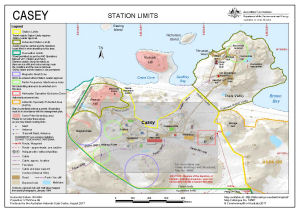 |
| 14533 | Casey: Station Limits | 2016 | 1 : 6000 |
 |
| 14484 | Casey: Station Limits | 2015 | 1 : 6000 |
 |
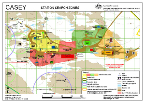
| 13791 | Casey: Station Search Zones | 2010 | 1 : 2250 |
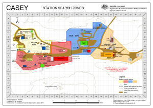 |
| 13520 | Casey: Station Search Zones | 2008 | 1 : 2500 |
 |
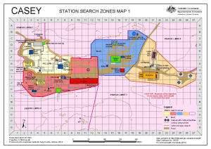
| 14315 | Casey: Station Search Zones Map 1 | 2014 | 1 : 2250 |
 |
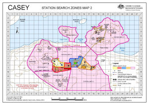
| 14324 | Casey: Station Search Zones Map 2 | 2014 | 1 : 6400 |
 |
| 14288 | Clark Peninsula to O'Brien Bay, Windmill Islands with Casey inset [Black and white] | 2014 | 1 : 85 000 |
 |
| 4 | Clark Peninsula, Site of Special Scientific Interest no.17 | 1996 | 1 : 10 000 |
 |
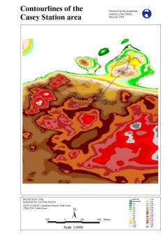
| 11185 | Contour lines of the Casey Station area | 1998 | 1 : 9500 |
 |
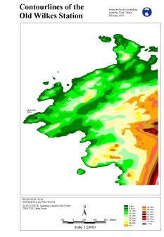
| 11165 | Contour lines of the old Wilkes Station | 1998 | 1 : 23 000 |
 |
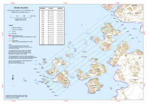
| 13925 | Cronk Islands Proposed Aerial Photography 2010-11 |
2010 | 1 : 25 000 |
 |
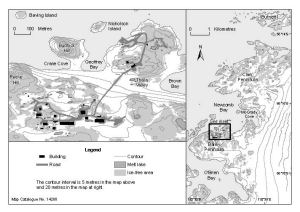
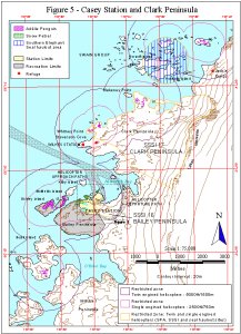
| 11369 | Figure 5 - Casey Station and Clark Peninsula Helicopter Operations | 1999 | 1 : 75 000 |
 |
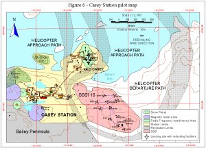
| 11370 | Figure 6 - Casey Station pilot map Helicopter Operations | 1999 | 1 : 12 500 |
 |
| 12748 | Geology of the Windmill Islands - Lithology | 1997 | 1 : 50 000 |
 |
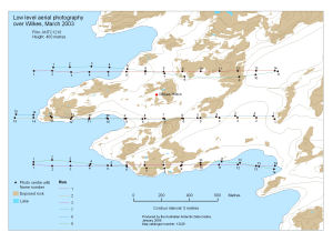
| 13229 | Low level aerial photography over Wilkes, March 2003 | 2006 | 1 : 8000 |
 |
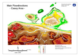
| 11145 | Main flow directions Casey Area |
1998 | 1 : 6000 |
 |
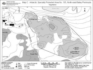
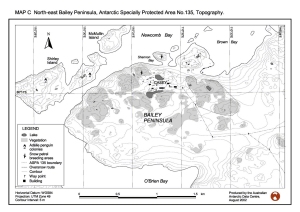
| 14180 | Map B: Antarctic Specially Protected Area No. 135, North-east Bailey Peninsula, Topography and Bird Distribution | 2012 | 1 : 6000 |
 |
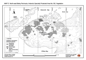
| 14181 | Map C: Antarctic Specially Protected Area No. 135, North-east Bailey Peninsula, Vegetation | 2012 | 1 : 6000 |
 |
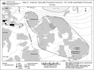
| 14182 | Map D: Antarctic Specially Protected Area No. 135, North-east Bailey Peninsula, Geology | 2012 | 1 : 6000 |
 |
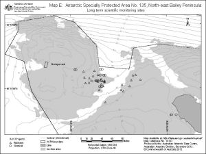
| 14183 | Map E: Antarctic Specially Protected Area No. 135, North-east Bailey Peninsula, Long term scientific monitoring sites | 2012 | 1 : 2000 |
 |
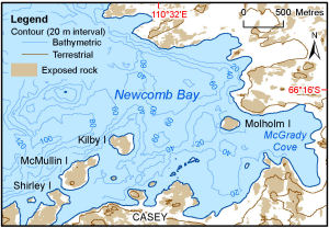
| 14109 | Newcomb Bay | 2012 | 1 : 47 000 |
 |
| 12940 | North-east Bailey Peninsula, Antarctic Specially Protected Area No. 135 | 2002 | 1 : 4000 |
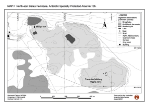 |
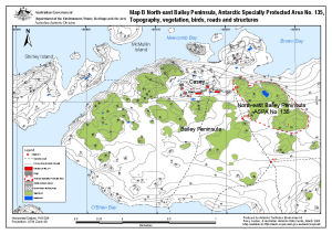
| 13512 | North-east Bailey Peninsula, Antarctic Specially Protected Area No. 135 : Topography, vegetation, birds, roads and structures (Map B) | 2008 | 1 : 12 000 |
 |
| 12937 | North-east Bailey Peninsula, Antarctic Specially Protected Area No. 135, Topography | 2002 | 1 : 15 400 |
 |
| 12938 | North-east Bailey Peninsula, Antarctic Specially Protected Area No. 135, Vegetation | 2002 | 1 : 15 400 |
 |
| 12930 | Oil spill site at Casey Station: predicted flow paths, predicted drainage basins, measured hydrocarbon concentrations (Fig 1) | 2002 | 1 : 700 |
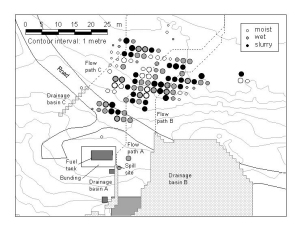 |
| 12931 | Oil spill site at Casey Station: predicted flow paths, predicted drainage basins, measured hydrocarbon concentrations (Fig 2) | 2002 | 1 : 2600 |
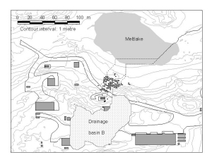 |
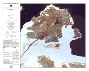
| 12887 | Old Casey and Thala valley : Orthophoto map | 2002 | 1 : 1000 |
 |
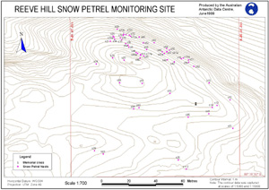
| 11208 | Reeve Hill Snow Petrel Monitoring Site | 1999 | 1 : 700 |
 |
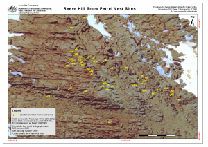
| 13993 | Reeve Hill Snow Petrel Nest Sites | 2011 | 1 : 385 |
 |
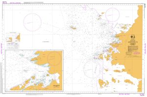
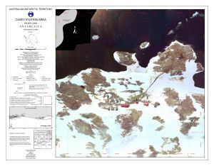
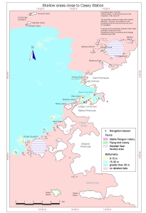
| 12830 | Shallow areas close to Casey Station | 2001 | 1 : 85 000 |
 |
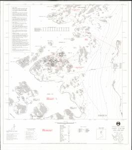
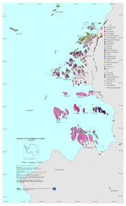
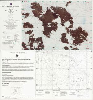
| 5 | Site of Special Scientific Interest Number 16, Wilkes Land, Antarctica | 1996 | 1 : 2000 |
 |
| 195 | Western approaches to Casey | 1997 | 1 : 25 000 | |
| 292 | Wilkes Station Approaches | 1987 | 1 : 50 000 | |
| 317 | Wilkes Station Approaches | 1966 | 1 : 50 000 | |
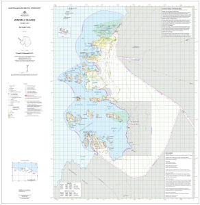
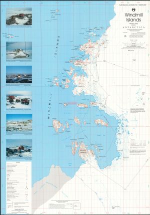
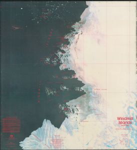
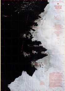
| 5811 | Windmill Islands | 1969 | 1 : 50 000 | |
| 14238 | Windmill Islands | 2013 | 1 : 50 000 |
 |
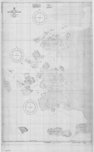
| 5796 | Windmill Islands - Sheet 1 | 1956 | 1 : 12 000 |
 |
| 5104 | Windmill Islands / Wilkes Land | 1997 | 1 : 50 000 |
 |
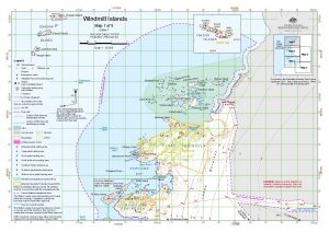
| 13297 | Windmill Islands : Map 1 of 5 | 2006 | 1 : 50 000 |
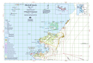 |
| 14110 | Windmill Islands : Map 1 of 5 | 2012 | 1 : 50 000 |
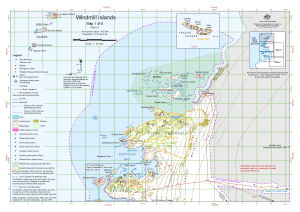 |
| 13920 | Windmill Islands : Map 1 of 5 | 2011 | 1 : 50 000 |
 |
| 13494 | Windmill Islands : Map 1 of 5 | 2008 | 1 : 50 000 |
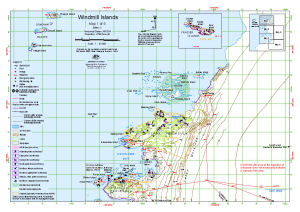 |
| 13426 | Windmill Islands : Map 1 of 5 | 2007 | 1 : 50 000 |
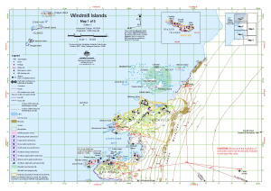 |
| 13651 | Windmill Islands : Map 1 of 5 | 2009 | 1 : 50 000 |
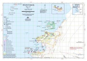 |
| 14613 | Windmill Islands : Map 1 of 5 | 2017 | 1 : 50 000 |
 |
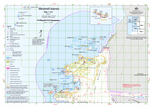
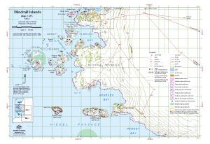
| 14614 | Windmill Islands : Map 2 of 5 | 2017 | 1 : 50 000 |
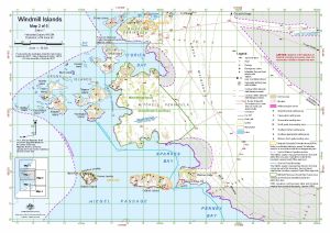 |
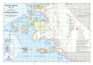
| 13652 | Windmill Islands : Map 2 of 5 | 2009 | 1 : 50 000 |
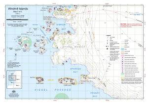 |
| 13427 | Windmill Islands : Map 2 of 5 | 2007 | 1 : 50 000 |
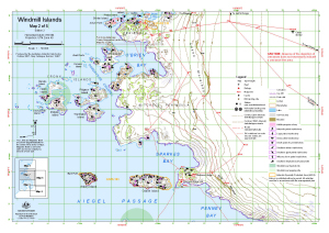 |
| 13495 | Windmill Islands : Map 2 of 5 | 2008 | 1 : 50 000 |
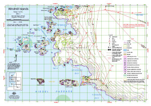 |
| 13921 | Windmill Islands : Map 2 of 5 | 2011 | 1 : 50 000 |
 |
| 14111 | Windmill Islands : Map 2 of 5 | 2012 | 1 : 50 000 |
 |
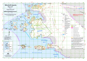
| 13298 | Windmill Islands : Map 2 of 5 | 2006 | 1 : 50 000 |
 |
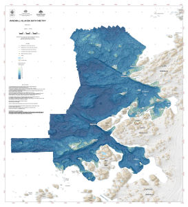
| 14565 | Windmill Islands Bathymetry | 2017 | 1 : 15 000 |
 |
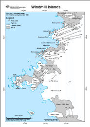
| 13196 | Windmill Islands Flight lines and photograph centres from the Linhof camera, December 1990 | 2005 | 1 : 50 000 |
 |
| 13008 | Windmill Islands, Wilkes Land | 1989 | 1 : 50 000 |
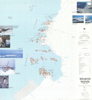 |
| 13012 | Windmill Islands, Wilkes Land | 1989 | 1 : 50 000 |
 |
| 10 | Windmill Islands, Wilkes Land | 1995 | 1 : 50 000 |
 |