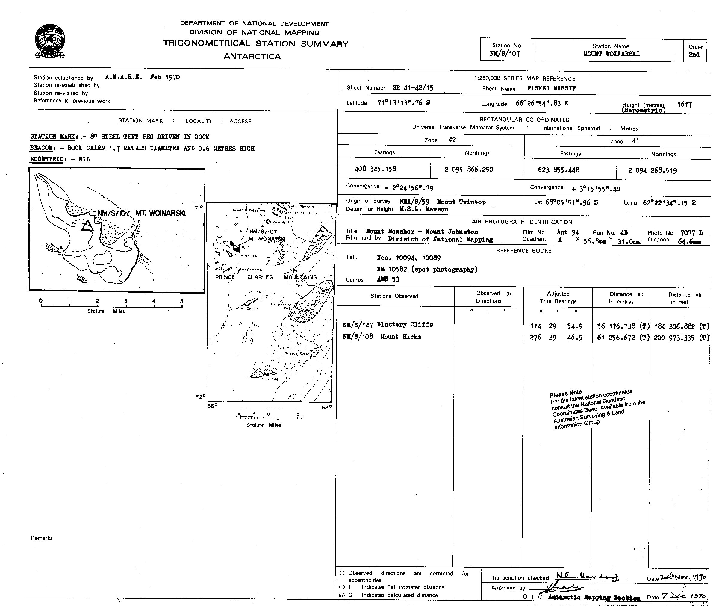
NMS107 station information
Station identification
- Primary name
- NMS107
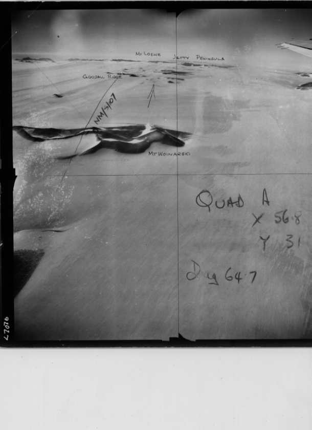
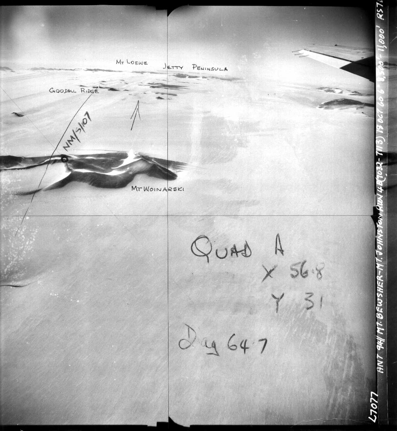
Locality
Mount Woinarski
View place name details in the gazetteer
Type
NGCP Control - Station 40026
This station is part of the Geoscience Australia National Geodetic Data Base - you will have to renavigate to the station page.
General
- Date last visited
- No visits or not recorded (if present then see metadata record)
- Date last maintained
- Location details
| Coordinates |
| ||||||||||||||||||||||||||||||||||||||||||||||||||||||||||||
| Orthometric Heights |
| ||||||||||||||||||||||||||||||||||||||||||||||||||||||||||||
| Documents |
|
Nearby Stations within 0.25 degrees of this station.
| Site | Locality | Distance / Bearing |
|---|