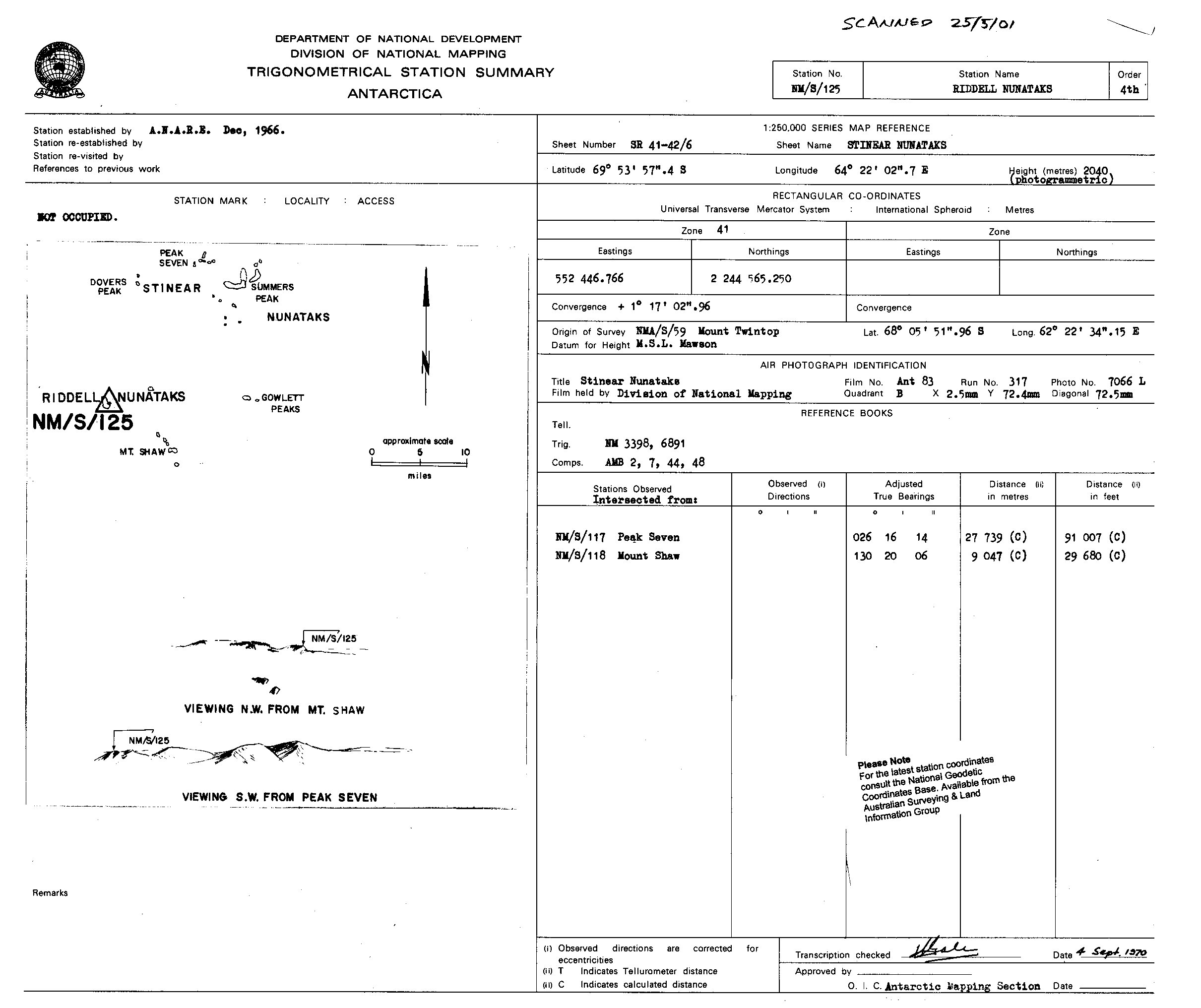
NMS125 station information
Station identification
- Primary name
- NMS125
Locality
Riddell Nunataks
View place name details in the gazetteer
Type
NGCP Control - Station 40032
This station is part of the Geoscience Australia National Geodetic Data Base - you will have to renavigate to the station page.
General
- Date last visited
-
No visits or not recorded (if present then see metadata record)
- Date last maintained
- Location details
| Coordinates |
| Datum | Latitude | Longitude | Accuracy (m) | Order | Grid | Easting | Northing | Date released | Status |
| ITRF2000 |
-69° 53' 51.244720"
-69.89756798 |
64° 21' 51.623890"
64.36433997 |
1.5 |
|
41 |
552330.320 |
2244964.620 |
16-Aug-2001 |
Current |
| ITRF96 |
-69° 53' 51.244591"
-69.89756794 |
64° 21' 51.621800"
64.36433939 |
|
3 |
41 |
552330.300 |
2244964.630 |
|
Current |
| ITRF96 |
-69° 53' 51.244591"
-69.89756794 |
64° 21' 51.621800"
64.36433939 |
|
3 |
41 |
552330.300 |
2244964.630 |
|
Superseded |
| WGS84 |
-69° 53' 51.269570"
-69.89757488 |
64° 21' 51.542540"
64.36431737 |
|
3 |
41 |
552329.440 |
2244963.870 |
|
Superseded |
| WGS84 |
-69° 53' 51.269570"
-69.89757488 |
64° 21' 51.542540"
64.36431737 |
|
3 |
41 |
552329.440 |
2244963.870 |
|
Current |
|
Orthometric
Heights |
| Datum | Height (m) | Accuracy (m) | Order | Date released | Status |
| |
2040 |
|
4 |
|
Current |
|
| Documents |
|
There are no nearby stations within 0.25 degrees of this station.