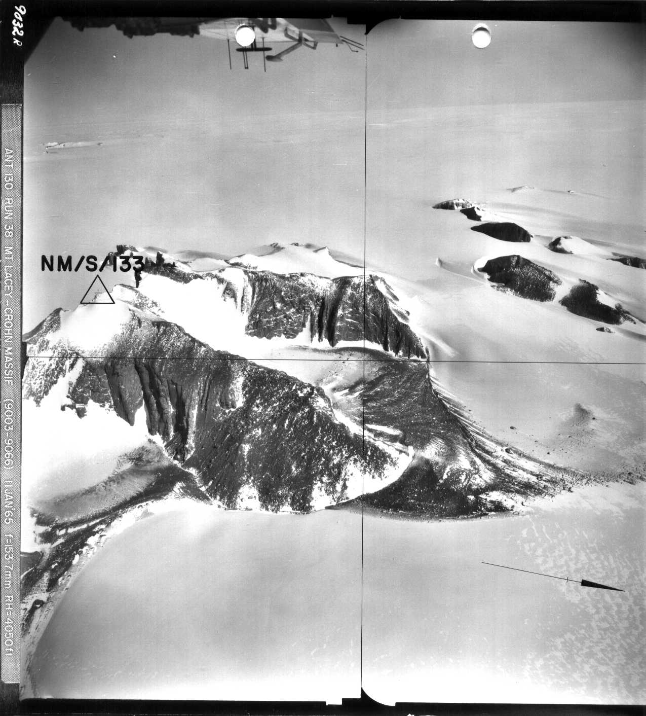
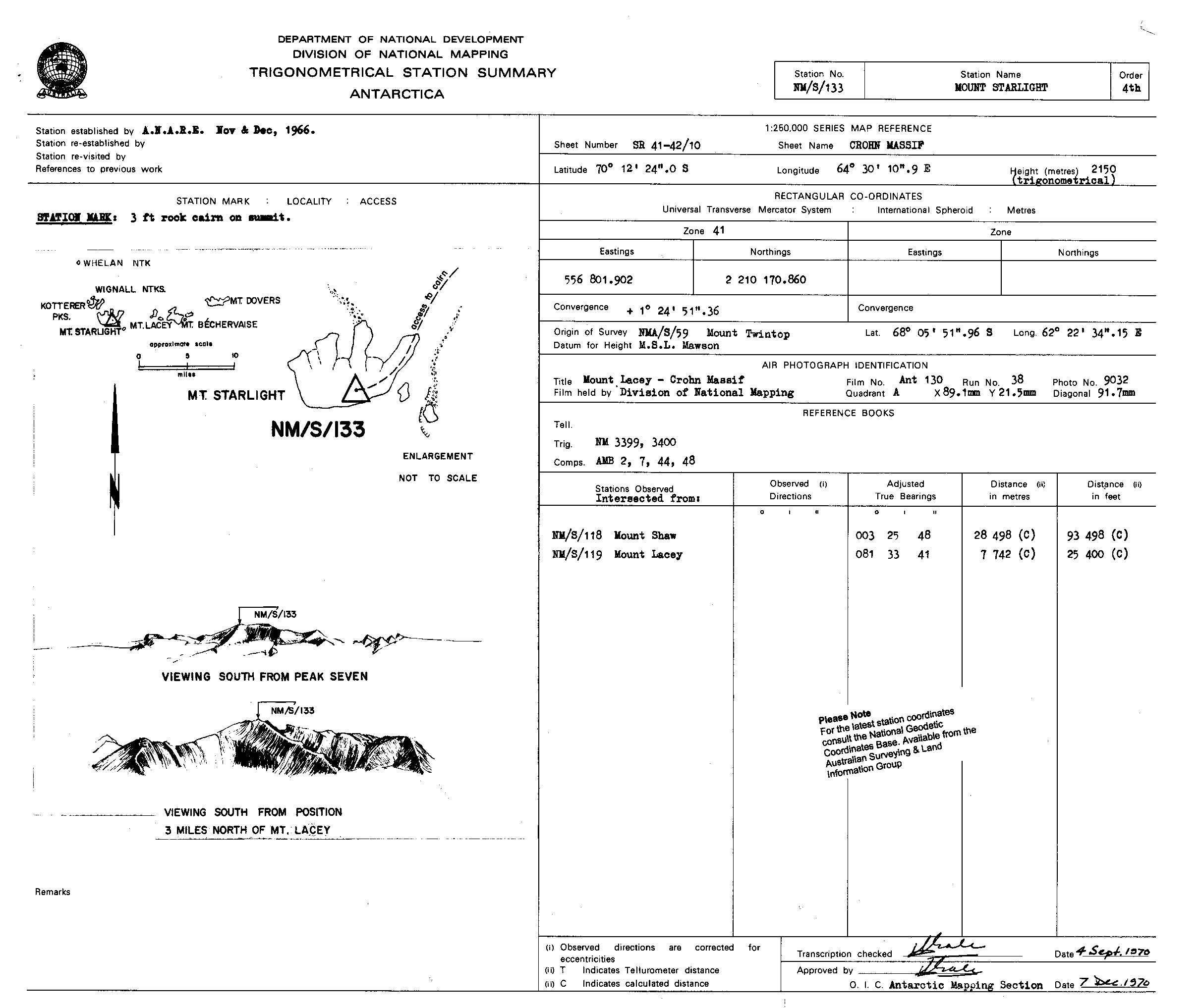
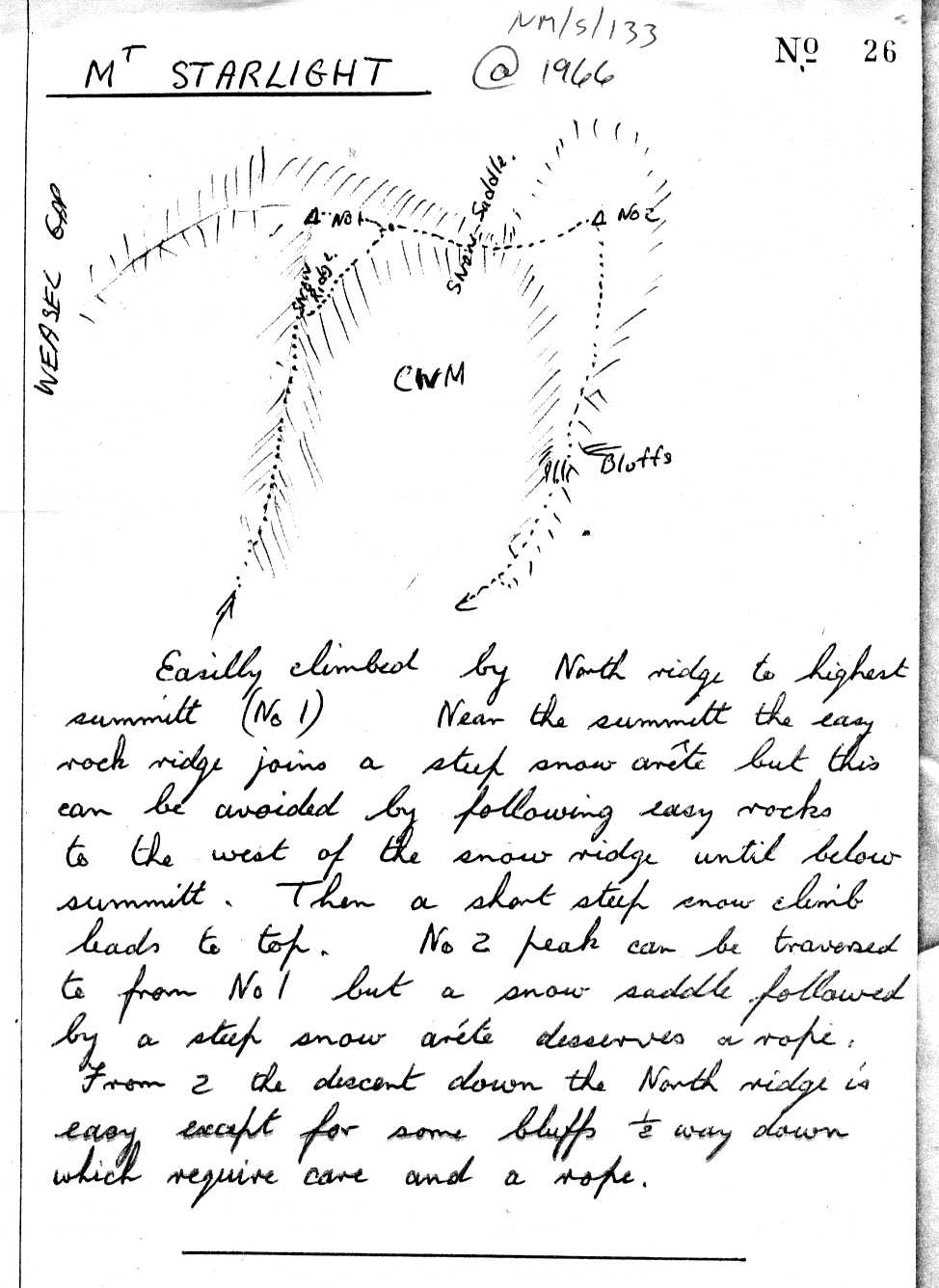
NMS133 station information
Station identification
- Primary name
- NMS133
Locality
Starlight
Type
NGCP Control - Station 40036
This station is part of the Geoscience Australia National Geodetic Data Base - you will have to renavigate to the station page.
General
- Date last visited
-
No visits or not recorded (if present then see metadata record)
- Date last maintained
- Location details
| Coordinates |
| Datum | Latitude | Longitude | Accuracy (m) | Order | Grid | Easting | Northing | Date released | Status |
| ITRF2000 |
-70° 12' 17.871150"
-70.20496421 |
64° 29' 58.889590"
64.49969155 |
1.3 |
|
41 |
556677.570 |
2210571.550 |
16-Aug-2001 |
Current |
| ITRF96 |
-70° 12' 17.871040"
-70.20496418 |
64° 29' 58.887600"
64.49969100 |
|
3 |
41 |
556677.550 |
2210571.550 |
|
Current |
| ITRF96 |
-70° 12' 17.871040"
-70.20496418 |
64° 29' 58.887600"
64.49969100 |
|
3 |
41 |
556677.550 |
2210571.550 |
|
Superseded |
| WGS84 |
-70° 12' 17.896140"
-70.20497115 |
64° 29' 58.835990"
64.49967666 |
|
3 |
41 |
556676.990 |
2210570.790 |
|
Superseded |
| WGS84 |
-70° 12' 17.896140"
-70.20497115 |
64° 29' 58.835990"
64.49967666 |
|
3 |
41 |
556676.990 |
2210570.790 |
|
Current |
|
Orthometric
Heights |
| Datum | Height (m) | Accuracy (m) | Order | Date released | Status |
| |
2150 |
|
4 |
|
Current |
|
| Documents |
|
There are no nearby stations within 0.25 degrees of this station.