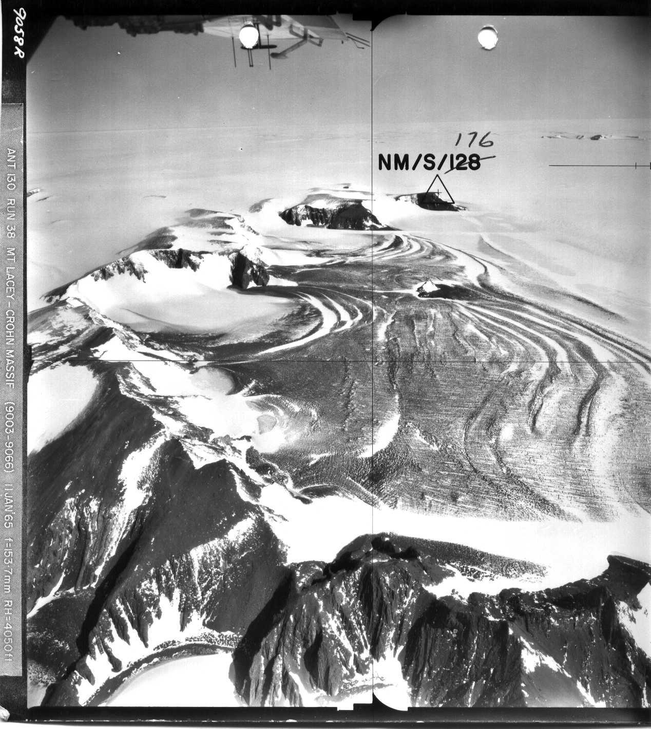
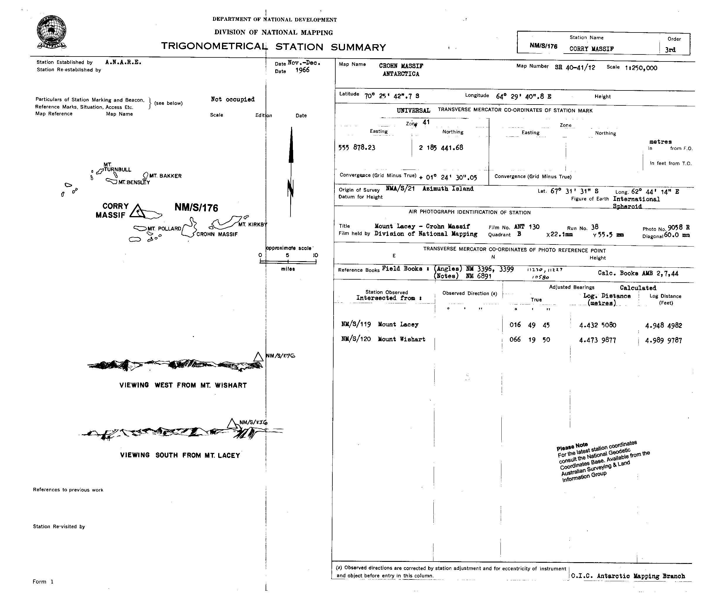
NMS176 station information
Station identification
- Primary name
- NMS176
Locality
Corry Massif
View place name details in the gazetteer
Type
NGCP Control - Station 40052
This station is part of the Geoscience Australia National Geodetic Data Base - you will have to renavigate to the station page.
General
- Date last visited
-
No visits or not recorded (if present then see metadata record)
- Date last maintained
- Location details
| Coordinates |
| Datum | Latitude | Longitude | Accuracy (m) | Order | Grid | Easting | Northing | Date released | Status |
| ITRF2000 |
-70° 26' 57.522230"
-70.44931173 |
64° 39' 29.643920"
64.65823442 |
0.9 |
|
41 |
561925.540 |
2183175.000 |
16-Aug-2001 |
Current |
| ITRF96 |
-70° 26' 57.522226"
-70.44931173 |
64° 39' 29.642361"
64.65823399 |
|
3 |
41 |
561925.520 |
2183175.000 |
|
Superseded |
| ITRF96 |
-70° 26' 57.522226"
-70.44931173 |
64° 39' 29.642361"
64.65823399 |
|
3 |
41 |
561925.520 |
2183175.000 |
|
Current |
| WGS84 |
-70° 26' 57.551200"
-70.44931978 |
64° 39' 29.619880"
64.65822774 |
|
3 |
41 |
561925.260 |
2183174.110 |
|
Superseded |
| WGS84 |
-70° 26' 57.551200"
-70.44931978 |
64° 39' 29.619880"
64.65822774 |
|
3 |
41 |
561925.260 |
2183174.110 |
|
Current |
|
Orthometric
Heights |
| Datum | Height (m) | Accuracy (m) | Order | Date released | Status |
| |
2065 |
|
|
|
Current |
|
| Documents |
|
There are no nearby stations within 0.25 degrees of this station.