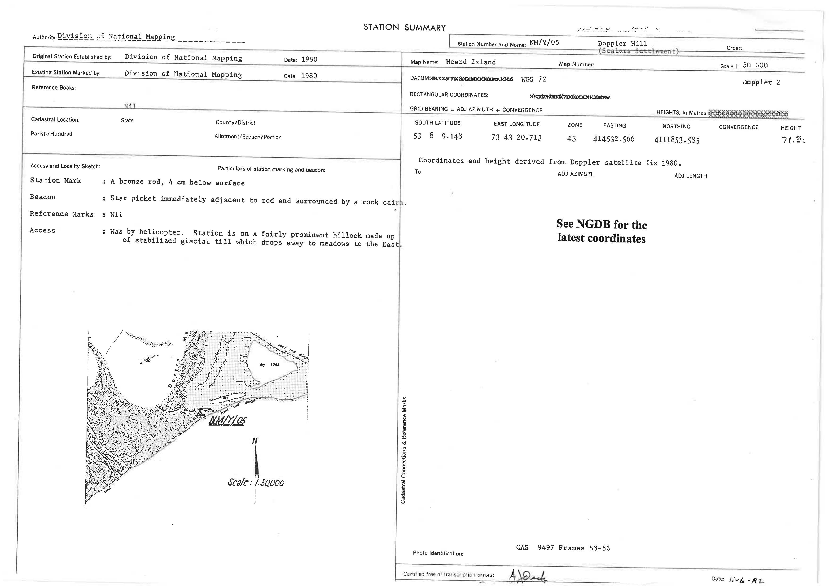
NMY05 station information
Station identification
- Primary name
- NMY05
Locality
Doppler Hill
View place name details in the gazetteer
Type
NGCP Control - Station 40632
This station is part of the Geoscience Australia National Geodetic Data Base - you will have to renavigate to the station page.
General
- Date last visited
-
No visits or not recorded (if present then see metadata record)
- Date last maintained
- Location details
| Coordinates |
| Datum | Latitude | Longitude | Accuracy (m) | Order | Grid | Easting | Northing | Date released | Status |
| ITRF2000 |
-53° 8' 9.131000"
-53.13586972 |
73° 43' 21.194300"
73.72255397 |
0.05 |
|
43 |
414541.470 |
4111852.660 |
1-Sep-2001 |
Current |
| WGS84 |
-53° 8' 9.066900"
-53.13585192 |
73° 43' 21.267000"
73.72257417 |
|
|
43 |
414542.790 |
4111854.660 |
|
Superseded |
| WGS84 |
-53° 8' 9.066900"
-53.13585192 |
73° 43' 21.267000"
73.72257417 |
|
|
43 |
414542.790 |
4111854.660 |
|
Current |
|
Orthometric
Heights |
Height not determined for this survey station.
|
| Documents |
|
There are no nearby stations within 0.25 degrees of this station.