Collection Details
RMT-1 Trawl catch from the 2005/06 V3 BROKE-West voyage - ZooplanktonView list of biodiversity data collections |
©AAD, Copyright Commonwealth of Australia 2006
|
Collection Details
- Custodian
- Kerrie M. Swadling, So Kawaguchi and Graham W. Hosie
- Collection Acronym
- ZOO_BROKE_WEST
- Description
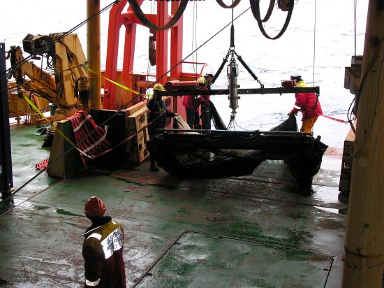
- Samples were collected at trawl stations (approximately every second CTD station), as well as opportunistically when something interesting was spotted on the Echosounder. The samples were collected with an RMT-1 plankton net and preserved in Steedman's solution. Upon returning to Australia, the samples were passed onto Kerrie Swadling, who split them with a Folsom plankton splitter so that between 400 and 1300 indivduials were counter per sample. Every organism was identified to the lowest possible taxon - in the case of copepods, usually to species and stage level. Other taxa are to species wherever possible. All the animals were counted and the results are expressed as abundance per 1000 cubic m.
- Domain
- Marine
- Taxa Groups
-
Zooplankton,
List 36 taxa from this collection - Collection Status
- Data collection complete
- Acknowledgements
- Antarctic mesozooplankton community structure during BROKE-West (30°E - 80°E), January - February 2006, Kerrie M. Swadling, So Kawaguchi and Graham W. Hosie, Deep Sea Research (2009) Deep-Sea Research II 57, 887¿904 doi:10.1016/j.dsr2.2008.10.041
- DiGIR Details
-
See International activities tab for details on publishing data to other repositories.
Resource Code: - zoo_broke_west Resource Name: - RMT-1 Trawl catch from the 2005/06 V3 BROKE-West voyage - Zooplankton Keywords: - RMT 1, net sampling Basis of Record: - Specimen For list of all collections published via DiGIR, see AADC DiGIR collections and the DiGIR harvesting point if you wish to harvest records
- Linked to the following Bioregions
-
Coastal Continental Antarctic - Enderby Land / Syowa
Coastal Continental Antarctic - Mac Robertson Land Coast
Data Details
- Data links
- Search the 1,140 observations belonging to this collection.
- Map
- No map exists.
- Spatial Coverage
-
61° 39' 46.8" S to 69° 06' 28.8" S | -61.6630° to -69.1080° 29° 59' 02.8" E to 80° 00' 57.6" E | 29.9841° to 80.0160° - Date Range of Collection
- 19-Jan to 27-Feb-2006
- Data collected from the following voyage(s)
Voyage Observation count Search 2005/06 V3 BROKE-West (details) 1140 search 
- Metadata
- BROKE-West_zooplankton - Zooplankton distribution and abundance during the BROKE-West survey