Name details
Aviation Islands
Aviation Islands (The name as it would appear in a gazetteer)
Aviation Islands (The name as it would appear on a map)
If this information is incorrect, please e-mail mapping@aad.gov.au
Feature type: Island
Origin
This name originates from New Zealand. It is part of the New Zealand Gazetteer and the SCAR Composite Gazetteer of Antarctica.
Names that other countries have for this feature:
- Aviation Islands (Australia)
- Aviation Islands (United States of America)
- Poljarnoj Aviacii, ostrova (Russia)
Narrative
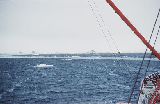
A group of small rocky islands 5km north of Cape Kinsey, north of the Goodman Hills at Davies Bay Hills. Feature depicted on: NZMS 166 SR57-58/5 (Jan 1967).
Named For
Mapped by the Soviet Antarctic Expedition (SovAE), 1958, and named Ostrova Polyarnoy Aviatsii (Polar Aviation Islands). Photographed from the air on 20th February, 1969 by Phillip Law, leader of the ANAR Expedition, on the MV Magga Dan. Law and a party from the MV Magga Dan landed on the southernmost island on 6 March, 1961. The feature is the site of an adélie penguin rookery.
Location
Images

©AAD, Copyright Commonwealth of Australia 1961
- Catalogue id
- 3930C5
- Caption
- 3 miles north of the Wilson Hills in Oates Land
- Photographer
- Law, Phillip Garth (Phil)
Map
Source
Comments
NULLApproval status
Display Scales
For example, selecting 'Aus_display_scale_20M' would only return names that would appear on a 1:20 million scale map.
| Aus_display_scale_20M: | No | Aus_display_scale_10M: | No | ||
| Aus_display_scale_5M: | No | Aus_display_scale_2M: | No | ||
| Aus_display_scale_1M: | No | Aus_display_scale_500k: | No | ||
| Aus_display_scale_250k: | No | Aus_display_scale_100k: | No | ||
| Aus_display_scale_50k: | No | Aus_display_scale_25k: | No | ||
| Aus_display_scale_10k: | No | Aus_display_scale_5k: | No | ||
| Aus_display_scale_1k: | No |
Related information
Biodiversity
View
fauna,
flora or
both
within 1.0 degree of this location
Place names
View
New Zealand or
international
place names within 1.0 degree of this location.