Name details
Mount Bayliss
Bayliss, Mount (The name as it would appear in a gazetteer)
Mount Bayliss (The name as it would appear on a map)
If this information is incorrect, please e-mail mapping@aad.gov.au
Feature type: Mountain
Origin
This name originates from Australia. It is part of the Australian Antarctic Gazetteer and the SCAR Composite Gazetteer of Antarctica.
Names that other countries have for this feature:
- Mount Bayliss (Russia)
- Mount Bayliss (United States of America)
Narrative
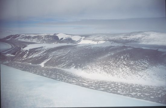
A fairly low, rock outcrop elongated east-west about 17 km east of Mount Menzies in Mac.Robertson Land. Discovered from an ANARE aircraft during 1957, also seen in that year from the ground by the southern seismic party led by K B Mather. Named after E P Bayliss, the cartographer who drew the map of Antarctica published in 1939 by the (then) Property and Survey Branch, Department of Interior, Canberra.
Named For
Location
Images
©AAD, Copyright Commonwealth of Australia 1995
- Catalogue id
- 2783B5
- Photographer
- Godbold, Mathew (Matt)
Map
Source
Comments
NoneApproval status
Display Scales
For example, selecting 'Aus_display_scale_20M' would only return names that would appear on a 1:20 million scale map.
| Aus_display_scale_20M: | No | Aus_display_scale_10M: | No | ||
| Aus_display_scale_5M: | No | Aus_display_scale_2M: | Yes | ||
| Aus_display_scale_1M: | Yes | Aus_display_scale_500k: | Yes | ||
| Aus_display_scale_250k: | Yes | Aus_display_scale_100k: | Yes | ||
| Aus_display_scale_50k: | Yes | Aus_display_scale_25k: | No | ||
| Aus_display_scale_10k: | No | Aus_display_scale_5k: | No | ||
| Aus_display_scale_1k: | No |
Related information
Biodiversity
View
fauna,
flora or
both
within 1.0 degree of this location
Place names
View
Australian or
international
place names within 1.0 degree of this location.