Bailey Peninsula
Bailey Peninsula (The name as it would appear in a gazetteer)
Bailey Peninsula (The name as it would appear on a map)
If this information is incorrect, please e-mail mapping@aad.gov.au
Place ID: 763
Name ID: 122099
Feature type:
Peninsula
(8)
Origin
This name originates from United States of America.
It is part of the
United States Gazetteer and the SCAR Composite Gazetteer of Antarctica.
Names that other countries have for this feature:
Narrative
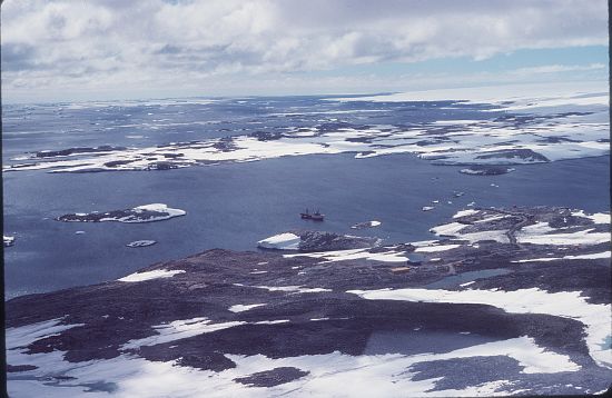
Rocky peninsula, 1.8 mi long and 1 mi wide, lying between Newcomb Bay and O'Brien Bay at the E side of the Windmill Islands. First mapped from USN Operation HighJump aerial photographs taken in February 1947 and thought to be an island connected by a steep snow ramp to the continental ice overlying Budd Coast. The term peninsula was considered more appropriate by the Wilkes Station party of 1957. Named by the US-ACAN for Cdr. Claude E. Bailey, USN, captain of the USS Henderson, destroyer escort of the western task group of USN Operation HighJump, Task Force 68, 1946-47.
Named For
Location
Latitude:
66° 17' 00.0" S
-66.28333°
Unknown precision
Longitude:
110° 32' 00.0" E
110.53333°
Unknown precision
Altitude:
Not recorded
Unknown precision
Images
©AAD, Copyright Commonwealth of Australia 1981
- Catalogue id
- 2903D1
- Photographer
- Reed, David (Dave)
Map
Source
Source Institution:
Unknown
Source Publisher:
Unknown
Remote sensing:
Not Applicable
Comments
None
Approval status
Date approved:
1-Jan-1956
Related information