Bailey Peninsula
Bailey Peninsula (The name as it would appear in a gazetteer)
Bailey Peninsula (The name as it would appear on a map)
If this information is incorrect, please e-mail mapping@aad.gov.au
Place ID: 763
Name ID: 2108
Feature type:
Peninsula
Origin
This name originates from Australia.
It is part of the
Australian Antarctic Gazetteer and the SCAR Composite Gazetteer of Antarctica.
Names that other countries have for this feature:
Narrative
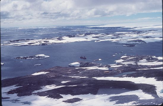
A rocky peninsula connected to the continental ice of the Budd Coast 2 km south of Clark peninsula. Delineated from air photographs taken by USN Operation Highjump (1946-47). Named by USACAN after Cmdr. C.E. Bailey, USN, captain of USS Henderson, destroyer escort of the western task group of Operation Highjump.
Named For
Location
Latitude:
66° 17' 08.9" S
-66.28581°
Accurate to 30m
Longitude:
110° 32' 00.0" E
110.53331°
Accurate to 30m
Altitude:
59 m
Accurate to 5m
Images
©AAD, Copyright Commonwealth of Australia 1981
- Catalogue id
- 2903D1
- Photographer
- Reed, David (Dave)
Map
Source
Location Method:
Topographic data
Source Name:
Windmill Islands 1:50000 GIS Dataset
Source Identifier:
Wind50K
Source Institution:
Australian Antarctic Division
Source Publisher:
Australian Antarctic Division
Remote sensing:
Not Applicable
Comments
None
Approval status
Date approved:
4-Jul-1961
Related information