Blundell Peak
Blundell Peak (The name as it would appear in a gazetteer)
Blundell Peak (The name as it would appear on a map)
If this information is incorrect, please e-mail mapping@aad.gov.au
Place ID: 1490
Name ID: 122653
Feature type:
Peak
(2d)
Origin
This name originates from United States of America.
It is part of the
United States Gazetteer and the SCAR Composite Gazetteer of Antarctica.
Names that other countries have for this feature:
Narrative
A rock peak on Stornes Peninsula in Prydz Bay. First mapped by Norwegian cartographers from air photos taken by the Lars Christensen Expedition, 1936-37. Named by ANCA for A.A. Blundell, radio operator at Mawson Station in 1968, who assisted in the ANARE tellurometer traverse from this peak to Reinbolt Hills in 1968.
Named For
Location
Latitude:
69° 24' 00.0" S
-69.40000°
Unknown precision
Longitude:
76° 06' 00.0" E
76.10000°
Unknown precision
Altitude:
Not recorded
Unknown precision
Images
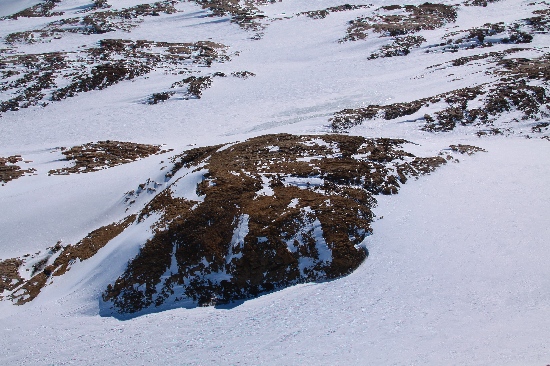
©Adam Christensen 2009
- Catalogue id
- IA21753
- Caption
- Blundell Peak, Larsemann Hills. Taken from helicopter at height of 1100 feet. Looking Southeast.
- Photographer
- Christensen, Adam
Map
Source
Source Institution:
Unknown
Source Publisher:
Unknown
Remote sensing:
Not Applicable
Comments
None
Approval status
Date approved:
1-Jan-1971
Related information