Blundell Peak
Blundell Peak (The name as it would appear in a gazetteer)
Blundell Peak (The name as it would appear on a map)
If this information is incorrect, please e-mail mapping@aad.gov.au
Place ID: 1490
Name ID: 1999
Feature type:
Peak
Origin
This name originates from Australia.
It is part of the
Australian Antarctic Gazetteer and the SCAR Composite Gazetteer of Antarctica.
Names that other countries have for this feature:
Narrative
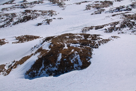
A prominent rock peak on Stornes Peninsula in the Larsemann Hills, about 160 m high. Mapped by Norwegian cartographers from air photographs taken by the Lars Christensen Expedition (1936-37). The feature was occupied as a survey station by ANARE in 1968 and 1969. Named after A A Blundell, radio operator-in-charge at Mawson in 1968, who assisted in the tellurometer traverse from this point to the Reinbolt Hills in 1968.
Named For
Location
Latitude:
69° 25' 33.7" S
-69.42604°
Accurate to 25m
Longitude:
76° 06' 15.0" E
76.10417°
Accurate to 25m
Altitude:
141 m
Accurate to 10m
Images
©Adam Christensen 2009
- Catalogue id
- IA21753
- Caption
- Blundell Peak, Larsemann Hills. Taken from helicopter at height of 1100 feet. Looking Southeast.
- Photographer
- Christensen, Adam
Map
Source
Location Method:
Surveyed
Source Name:
Larsemann Hills 1:25000 Topographic GIS Dataset
Source Identifier:
Lars25K
Source Institution:
Australian Antarctic Division
Source Publisher:
Australian Antarctic Division
Remote sensing:
Not Applicable
Comments
None
Approval status
Date approved:
22-Oct-1968
Related information