Chaos Glacier
Chaos Glacier (The name as it would appear in a gazetteer)
Chaos Glacier (The name as it would appear on a map)
If this information is incorrect, please e-mail mapping@aad.gov.au
Place ID: 2512
Name ID: 123447
Feature type:
Glacier
(12)
Origin
This name originates from United States of America.
It is part of the
United States Gazetteer and the SCAR Composite Gazetteer of Antarctica.
Names that other countries have for this feature:
Narrative
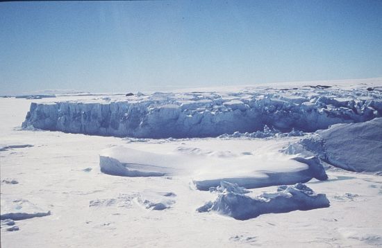
A glacier 4 mi S of Browns Glacier, flowing westward from Ingrid Christensen Coast into the central part of Ranvik Bay. Mapped by Norwegian cartographers from air photos taken by the Lars Christensen Expedition (1936-37). Named by John H. Roscoe in a 1952 study of USN Operation Highjump aerial photography of this coast. The name alludes to the jumbled appearance of the terminal glacial flowage.
Named For
Location
Latitude:
69° 01' 00.0" S
-69.01667°
Unknown precision
Longitude:
78° 00' 00.0" E
78.00000°
Unknown precision
Altitude:
Not recorded
Unknown precision
Images
©AAD, Copyright Commonwealth of Australia 1997
- Catalogue id
- 2283D2
- Caption
- [Location needs confirming]
- Photographer
- Houlahan, Darren
Map
Source
Source Institution:
Unknown
Source Publisher:
Unknown
Remote sensing:
Not Applicable
Comments
None
Approval status
Date approved:
1-Jan-1956
Related information