Ellis Fjord
Ellis Fjord (The name as it would appear in a gazetteer)
Ellis Fjord (The name as it would appear on a map)
If this information is incorrect, please e-mail mapping@aad.gov.au
Place ID: 4197
Name ID: 124783
Feature type:
Fjord
(3)
Origin
This name originates from United States of America.
It is part of the
United States Gazetteer and the SCAR Composite Gazetteer of Antarctica.
Names that other countries have for this feature:
Narrative
A long narrow fjord between Breidnes Peninsula and Mule Peninsula in the Vestfold Hills. Photographed by the Lars Christensen Expedition (1936-37), and plotted by Norwegian cartographers as a bay and a remnant lake which were called Mulvik (snout bay) and Langevatnet (the long lake) respectively. Analysis by John Roscoe of air photos taken by USN Operation Highjump (1946-47) showed these two features to be connected. The feature was renamed Ellis Fjord by Roscoe after Edwin E. Ellis, aerial photographer on USN Operation Highjump flights over this area.
Named For
Location
Latitude:
68° 36' 00.0" S
-68.60000°
Unknown precision
Longitude:
78° 05' 00.0" E
78.08333°
Unknown precision
Altitude:
Not recorded
Unknown precision
Images
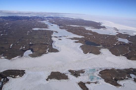
©Nathan Saunders 2009
- Catalogue id
- IA21886
- Caption
- Ellis Fjord, Vestfold Hills. Taken from helicopter at height of 2500 feet. Looking East.
- Photographer
- Saunders, Nathan
Map
Source
Source Institution:
Unknown
Source Publisher:
Unknown
Remote sensing:
Not Applicable
Comments
None
Approval status
Date approved:
1-Jan-1956
Related information