Crohn Massif
Crohn Massif (The name as it would appear in a gazetteer)
Crohn Massif (The name as it would appear on a map)
If this information is incorrect, please e-mail mapping@aad.gov.au
Place ID: 3131
Name ID: 1311
Feature type:
Massif
Origin
This name originates from Australia.
It is part of the
Australian Antarctic Gazetteer and the SCAR Composite Gazetteer of Antarctica.
Names that other countries have for this feature:
Narrative
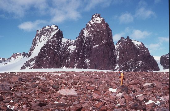
A large, domed massif west of Mt Kirkby in the Porthos Range, Prince Charles Mountains. It is approximately 7 km long east-west and 4 km wide, rising about 460 m above the surrounding plateau. It is not visible from the east or north-east. There are two small conical peaks of the eastern extremity. Sighted by the ANARE southern party, led by William G Bewsher, in January 1957, and named after Peter W Crohn, geologist at Mawson in 1955 and 1956.
Named For
Location
Latitude:
70° 28' 00.0" S
-70.46667°
Accurate to 200m
Longitude:
64° 55' 00.0" E
64.91667°
Accurate to 200m
Altitude:
Not recorded
Unknown precision
Images
©Doug Thost 1988
- Catalogue id
- 3478C4
- Caption
- John Gill in front of charnockite outcrop, Crohn Massif
- Photographer
- Thost, Douglas (Doug)
Map
Source
Source Name:
LIMA - Landsat Image Mosaic Antarctica
Source Institution:
Australian Antarctic Division
Source Publisher:
USGS - United Sates Geological Survey
Remote sensing:
Not Applicable
Comments
None
Approval status
Related information