Scullin Monolith
Scullin Monolith (The name as it would appear in a gazetteer)
Scullin Monolith (The name as it would appear on a map)
If this information is incorrect, please e-mail mapping@aad.gov.au
Place ID: 12925
Name ID: 1319
Feature type:
Monolith
Origin
This name originates from Australia.
It is part of the
Australian Antarctic Gazetteer and the SCAR Composite Gazetteer of Antarctica.
Names that other countries have for this feature:
Narrative
A crescent-shaped rock rising steeply from the sea to 443 m in height on the Mawson Coast of Mac.Robertson Land. Land was sighted in this vicinity of BANZARE (1929-31) during an aeroplane flight on 5 January, 1930. A landing was made by BANZARE on 13 February, 1931.
Named by Sir Douglas Mawson after James H. Scullin, Prime Minister of Australia, 1929-31.
Named For
Location
Latitude:
67° 47' 36.7" S
-67.79353°
Accurate to 100m
Longitude:
66° 43' 07.9" E
66.71886°
Accurate to 100m
Altitude:
443 m
Accurate to 20m
Images
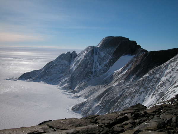
©Mike Woolridge 2002
- Catalogue id
- IA16483
- Caption
- West Face of Scullin Monolith from Apple hut site.
- Photographer
- Woolridge, Michael (Mike)
Map
Source
Location Method:
Satellite Image
Source Name:
LIMA - Landsat Image Mosaic Antarctica
Source Institution:
Australian Antarctic Division
Remote sensing:
Not Applicable
Comments
None
Approval status
Related information