Penguin Point
Penguin Point (The name as it would appear in a gazetteer)
Penguin Point (The name as it would appear on a map)
If this information is incorrect, please e-mail mapping@aad.gov.au
Place ID: 11075
Name ID: 2174
Feature type:
Point
Origin
This name originates from Australia.
It is part of the
Australian Antarctic Gazetteer and the SCAR Composite Gazetteer of Antarctica.
Names that other countries have for this feature:
Narrative
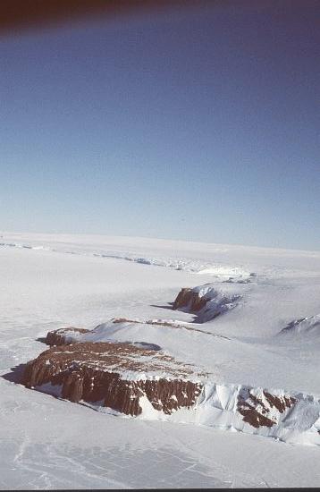
A granite point, about 97 m high, marking the western extremity of Murphy Bay, George V Land. Discovered and named by the eastern coastal party of AAE (1911-14) led by C.T. Madigan.
Named For
Location
Latitude:
67° 37' 04.1" S
-67.61781°
Accurate to 200m
Longitude:
146° 11' 06.8" E
146.18522°
Accurate to 200m
Altitude:
Not recorded
Unknown precision
Images
©AAD, Copyright Commonwealth of Australia 1986
- Catalogue id
- 1856C3
- Caption
- Penguin Point looking east
- Photographer
- Reeves, Robert D (Bob)
Map
Source
Location Method:
Satellite Image
Source Name:
LIMA - Landsat Image Mosaic Antarctica
Source Institution:
Australian Antarctic Division
Source Publisher:
USGS - United States Geological Survey
Remote sensing:
Not Applicable
Comments
None
Approval status
Related information