Cape Denison
Denison, Cape (The name as it would appear in a gazetteer)
Cape Denison (The name as it would appear on a map)
If this information is incorrect, please e-mail mapping@aad.gov.au
Place ID: 3525
Name ID: 281
Feature type:
Cape
Origin
This name originates from Australia.
It is part of the
Australian Antarctic Gazetteer and the SCAR Composite Gazetteer of Antarctica.
Names that other countries have for this feature:
Narrative
A rocky cape on the eastern side of Commonwealth Bay, on the coast of George V Land. Discovered in 1912 by AAE (1911-14) under Sir Douglas Mawson, who named it after Sir Hugh Denison of Sydney, a patron of the expedition.
Named For
Location
Latitude:
67° 00' 31.0" S
-67.00861°
Accurate to 20m
Longitude:
142° 40' 00.0" E
142.66667°
Accurate to 20m
Altitude:
Not recorded
Unknown precision
Images
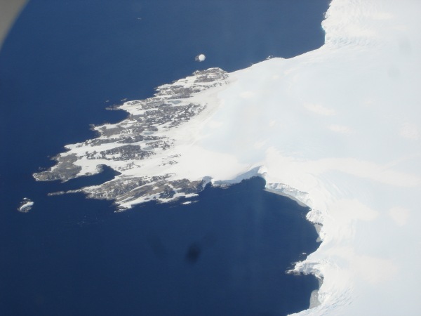
©Ursula Ryan 2005
- Catalogue id
- IA16564
- Caption
- Cape Denison from the air.
- Photographer
- Ryan, Ursula
Map
Source
Location Method:
Satellite Image
Source Identifier:
Satellite image (
No Image Available
Satellite Image Catalogue - Scene Id 2001013123204820000011627275 -
View Reference 
)
Source Institution:
Australian Antarctic Division
Source Publisher:
Unknown
Remote sensing:
Not Applicable
Comments
None
Approval status
Related information