Apfel Glacier
Apfel Glacier (The name as it would appear in a gazetteer)
Apfel Glacier (The name as it would appear on a map)
If this information is incorrect, please e-mail mapping@aad.gov.au
Place ID: 441
Name ID: 572
Feature type:
Glacier
Origin
This name originates from Australia.
It is part of the
Australian Antarctic Gazetteer and the SCAR Composite Gazetteer of Antarctica.
Names that other countries have for this feature:
Narrative
A glacier just south of Bunger Hills, Knox Coast, Wilkes Land. Delineated from air photographs taken by USN Operation Highjump (1946-47). Mapped by the Soviet Antarctic Expedition in 1956.
Named For
Location
Latitude:
66° 21' 29.0" S
-66.35806°
Accurate to 200m
Longitude:
100° 43' 15.0" E
100.72083°
Accurate to 200m
Altitude:
Not recorded
Unknown precision
Images
©AAD, Copyright Commonwealth of Australia 1999
- Catalogue id
- 3766D1
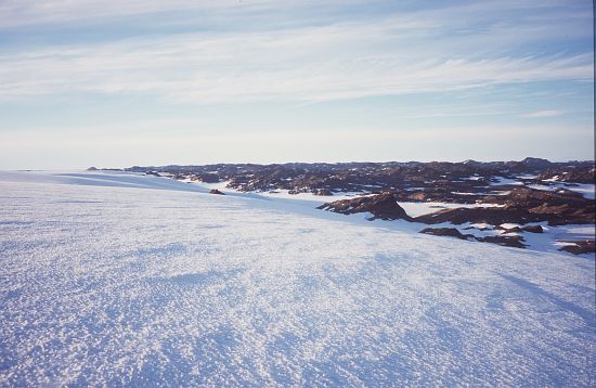
- Caption
- Ice slope between Apfel Glacier and Bunger Hills
- Photographer
- Shevlin, James
Map
Source
Location Method:
Satellite Image
Source Institution:
Australian Antarctic Division
Remote sensing:
Not Applicable
Comments
None
Approval status
Date approved:
22-Oct-1968
Related information