Mariner Islands
Mariner Islands (The name as it would appear in a gazetteer)
Mariner Islands (The name as it would appear on a map)
If this information is incorrect, please e-mail mapping@aad.gov.au
Place ID: 9003
Name ID: 781
Feature type:
Island
Origin
This name originates from Australia.
It is part of the
Australian Antarctic Gazetteer and the SCAR Composite Gazetteer of Antarctica.
Names that other countries have for this feature:
Narrative
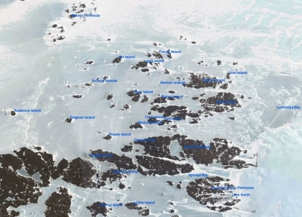
A group of islands in the north-east part of the Bunger Hills, just north of Booth Peninsula. Delineated from air photographs taken by USN Operation Highjump and named by USACAN after the Martin Mariner aircraft used on Operation Highjump.
Named For
Location
Latitude:
66° 03' 04.7" S
-66.05131°
Accurate to 200m
Longitude:
101° 10' 18.7" E
101.17186°
Accurate to 200m
Altitude:
Not recorded
Unknown precision
Images
©AAD Non-commercial use only 2000
- Catalogue id
- IA47444
- Caption
- Landsat LIMA image compiled from images E164_RGB_321_1X and E165_RGB_321_1X.
- Photographer
- Unknown
Map
Source
Location Method:
Satellite Image
Source Institution:
Australian Antarctic Division
Remote sensing:
Not Applicable
Comments
None
Approval status
Date approved:
22-Oct-1968
Related information