Haswell Island
Haswell Island (The name as it would appear in a gazetteer)
Haswell Island (The name as it would appear on a map)
If this information is incorrect, please e-mail mapping@aad.gov.au
Place ID: 6085
Name ID: 826
Feature type:
Island
Origin
This name originates from Australia.
It is part of the
Australian Antarctic Gazetteer and the SCAR Composite Gazetteer of Antarctica.
Names that other countries have for this feature:
Narrative
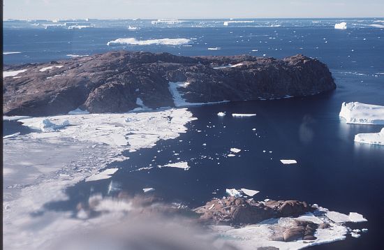
A rocky island about 1 km wide, 4 km off the coast of Queen Mary Land, just east of McDonald Bay.
Named For
Discovered by the Western Base Party of AAE (1911-14). Named by Sir Douglas Mawson after Prof. W.A. Haswell of Sydney, a member of the AAE Advisory Committee.
Location
Latitude:
66° 31' 33.1" S
-66.52586°
Accurate to 200m
Longitude:
92° 59' 38.4" E
92.99400°
Accurate to 200m
Altitude:
Not recorded
Unknown precision
Images
©AAD, Copyright Commonwealth of Australia 1985
- Catalogue id
- 2084A1
- Caption
- Near Mirny
- Photographer
- Johnstone, Gavin W
Map
Source
Location Method:
Satellite Image
Source Name:
LIMA - Landsat Image Mosaic Antarctica
Source Institution:
Australian Antarctic Division
Source Publisher:
USGS - United States Geological Survey
Remote sensing:
Not Applicable
Comments
None
Approval status
Date approved:
28-Nov-1955
Related information