Ardery Island
Ardery Island (The name as it would appear in a gazetteer)
Ardery Island (The name as it would appear on a map)
If this information is incorrect, please e-mail mapping@aad.gov.au
Place ID: 476
Name ID: 847
Feature type:
Island
Origin
This name originates from Australia.
It is part of the
Australian Antarctic Gazetteer and the SCAR Composite Gazetteer of Antarctica.
Names that other countries have for this feature:
Narrative
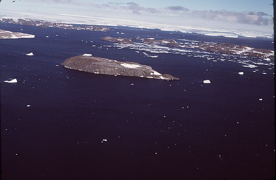
An island of the Windmill Islands off the Budd Coast, about 2 km west of Odbert Island. Delineated by air photographs taken by USN Operation Highjump (1946-47).
Named For
Location
Latitude:
66° 22' 14.9" S
-66.37081°
Accurate to 30m
Longitude:
110° 27' 00.0" E
110.45000°
Accurate to 30m
Altitude:
117 m
Accurate to 5m
Images
©Butler, Rowan 1985
- Catalogue id
- 236D5
- Photographer
- Butler, Rowan
Map
Source
Location Method:
Topographic data
Source Name:
Windmill Islands 1:50000 GIS Dataset
Source Identifier:
Metadata (
Wind50k - Windmill Islands 1:50000 Topographic GIS Dataset )
Source Institution:
Australian Antarctic Division
Source Publisher:
Australian Antarctic Division
Remote sensing:
Not Applicable
Comments
None
Approval status
Date approved:
4-Jul-1961
Related information