Rauer Group
Rauer Group (The name as it would appear in a gazetteer)
Rauer Group (The name as it would appear on a map)
If this information is incorrect, please e-mail mapping@aad.gov.au
Place ID: 11898
Name ID: 962
Feature type:
Island
Origin
This name originates from Australia.
It is part of the
Australian Antarctic Gazetteer and the SCAR Composite Gazetteer of Antarctica.
Names that other countries have for this feature:
Narrative
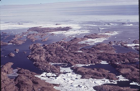
A group of rocky islands lying between the Sørsdal Glacier tongue and Ranvik Bay off Ingrid Christensen Coast. Discovered and called Rauer by a Norwegian expedition under Mikkelsen in February, 1935.
Named For
Location
Latitude:
68° 51' 00.0" S
-68.85000°
Unknown precision
Longitude:
77° 50' 00.0" E
77.83331°
Unknown precision
Altitude:
143 m
Unknown precision
Images
©AAD, Copyright Commonwealth of Australia 1974
- Catalogue id
- 240D5
- Photographer
- Williams, Richard (Dick)
Map
Source
Source Institution:
Unknown
Source Publisher:
Unknown
Remote sensing:
Not Applicable
Comments
None
Approval status
Date approved:
20-Aug-1957
Related information