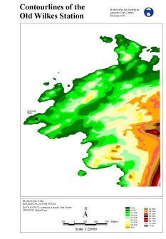
Map 11165: Contour lines of the old Wilkes Station
Map details
| Map Number | 11165 |
| Title | Contour lines of the old Wilkes Station |
| Edition | 1 |
| Scale | 1 : 23 000 |
| Publication date | June 1998 |
| Publisher |
Australian Antarctic Division (Australia)
|
| Spatial coverage |
(110.5161° -66.2336°)
,
(110.6006° -66.2336°)
,
(110.6006° -66.2736°)
(110.5161° -66.2736°) |
| Projection | Universal Transverse Mercator |
| Physical size | 29.7 x 21 cm |
| Notes | Part of series of maps used for the Environmental Management Program - Applied GIS for contaminated sites at the "old" Casey Station tip and abandoned Wilkes Station. |
| Keywords | Topographic , Reese |
Downloads
This is a digital map available for downloading.
Map Lists
No maps lists available.
Additional Information
| Horizontal datum | WGS84 |
| Vertical unit | Metres |
Preview