Map 11506: Judge and Clerk Islands proposed aerial photography 1999-2000
Map details
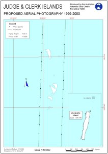
| Map Number | 11506 |
| Title | Judge and Clerk Islands proposed aerial photography 1999-2000 |
| Edition | 1 |
| Scale | 1 : 10 000 |
| Publication date | June 1999 |
| Publisher |
Australian Antarctic Division (Australia)
|
| Spatial coverage |
(158.0083° -54.3500°)
,
(158.9750° -54.3500°)
,
(158.9750° -54.3750°)
(158.0083° -54.3750°) |
| Projection | Universal Transverse Mercator |
| Physical size | 84 x 119 cm |
| Keywords | Topographic |
Downloads
No downloads available.
Map Lists
No maps lists available.
Additional Information
Preview