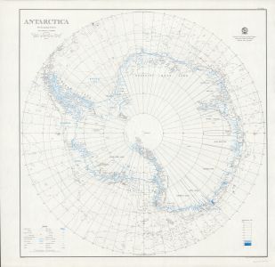
Map 1206: Antarctica
Map details
| Map Number | 1206 |
| Title | Antarctica |
| Edition | 3b (Out of Date) |
| Previous edition | [Previous edition : 3a] |
| Next Edition | [Next Edition : 4] |
| Scale | 1 : 10 000 000 |
| Publication date | July 1961 |
| Publisher |
Department of National Development, Division of National Mapping (Australia)
|
| Spatial coverage |
(-180.0000° -60.0000°)
,
(180.0000° -60.0000°)
,
(180.0000° -90.0000°)
(-180.0000° -90.0000°) |
| Projection | Polar Stereographic |
| Physical size | 76 x 74 cm |
| Notes | Without claims. There is a black and blue edition 3 published in 1961(This entry) and a colour edition 3 published in 1960 (Map 14707). |
| Reference | NMP/61/051 |
| Keywords | Nmp/61/051 , Topographic |
Downloads
This is a hard copy map that has been scanned. See information about obtaining copies of hard copy maps.
- National Library of Australia Bib ID 896103 (External site)
- A LZW compressed TIFF (blue coastline)
- A LZW compressed TIFF (b&w)
- A print file (PDF) (blue coastline)
- A print file (PDF) (b&w)
Map Lists
No maps lists available.
Additional Information
| Nomenclature | Australian Antarctic Gazetteer |
Preview