Map 12143: Cape Denison
Map details
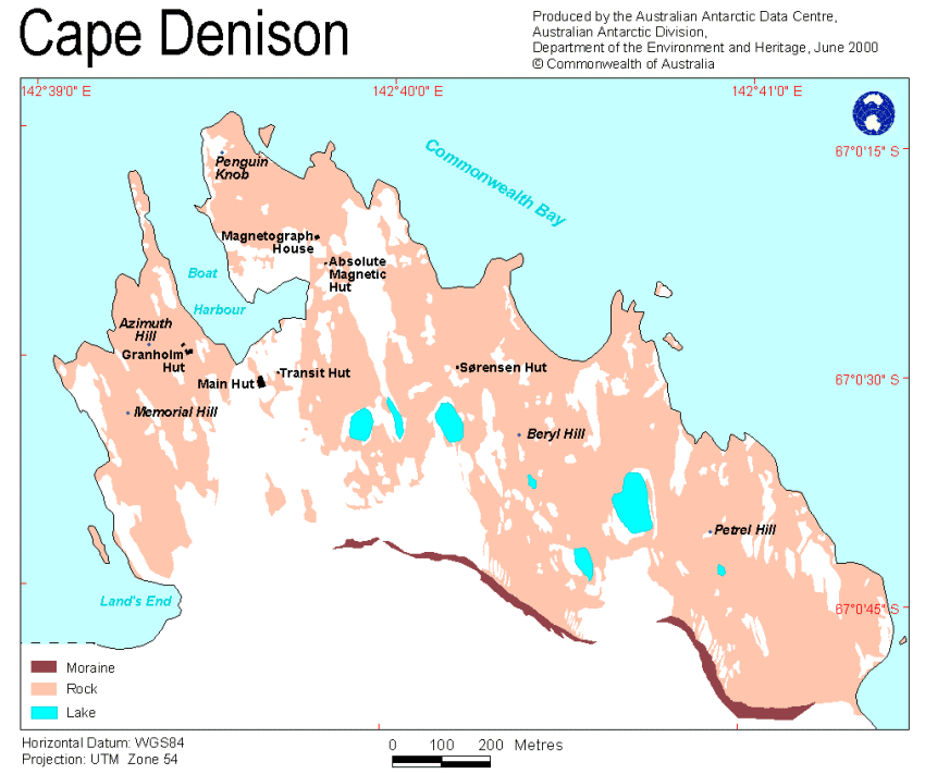
| Map Number | 12143 |
| Title | Cape Denison |
| Edition | 1 |
| Scale | Not Entered |
| Publication date | June 2000 |
| Publisher |
Australian Antarctic Division (Australia)
|
| Spatial coverage |
(142.6300° -67.0000°)
,
(142.7000° -67.0000°)
,
(142.7000° -67.0200°)
(142.6300° -67.0200°) |
| Projection | Universal Transverse Mercator |
| Physical size | 21 x 29.7 cm A4 |
| Keywords | Topographic |
Downloads
This is a digital map available for downloading.
Map Lists
This map belongs to the following lists. Use the link on the list to see all maps belonging to that list
Additional Information
Preview
