Map 12205: Rauer Group Helicopter Access
Map details
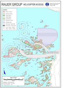
| Map Number | 12205 |
| Title | Rauer Group Helicopter Access |
| Edition | 1 |
| Scale | 1 : 80 000 |
| Publication date | October 1998 |
| Publisher |
Australian Antarctic Division (Australia)
|
| Spatial coverage |
( 77.5800° -68.6700°)
,
( 78.0800° -68.6700°)
,
( 78.0800° -69.0000°)
( 77.5800° -69.0000°) |
| Projection | Universal Transverse Mercator |
| Physical size | 29.7 x 21 cm A4 |
| Keywords | - |
Downloads
This is a digital map available for downloading.
Map Lists
No maps lists available.
Additional Information
Preview