Map 12553: Ardery and Orbert Islands (SPA 3) (Helicopter Operations)
Map details
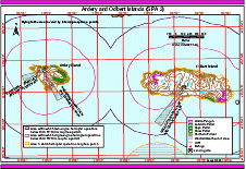
| Map Number | 12553 |
| Title | Ardery and Orbert Islands (SPA 3) (Helicopter Operations) |
| Edition | 2 (Out of Date) |
| Next Edition | [Next Edition : 3] |
| Scale | 1 : 26 000 |
| Publication date | August 2000 |
| Publisher | - |
| Spatial coverage |
(110.4300° -66.3500°)
,
(110.5670° -66.3500°)
,
(110.5670° -66.3900°)
(110.4300° -66.3900°) |
| Projection | Universal Transverse Mercator |
| Physical size | 21 x 29.7 cm A4 |
| Notes | Used in the publication "Flight paths for helicopter operations in Australian Antarctic Territory". Edition 2 of the maps, August 2000. |
| Keywords | - |
Downloads
This is a digital map available for downloading.
Map Lists
No maps lists available.
Additional Information
Preview