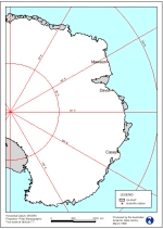
Map 12640: East Antarctica
Map details
| Map Number | 12640 |
| Title | East Antarctica |
| Edition | 1 |
| Scale | Not Entered |
| Publication date | March 1999 |
| Publisher |
Australian Antarctic Division (Australia)
|
| Spatial coverage |
( 0.0000° -60.0000°)
,
(180.0000° -60.0000°)
,
(180.0000° -90.0000°)
( 0.0000° -90.0000°) |
| Projection | Polar Stereographic |
| Physical size | 29.7 x 21 cm A4 |
| Keywords | Topographic |
Downloads
Map Lists
This map belongs to the following lists. Use the link on the list to see all maps belonging to that list
Additional Information
Preview