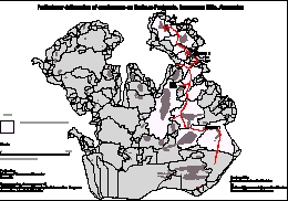
Map 12660: Preliminary - Preliminary delineation of catchments on Broknes Peninsula, Larsemann Hills, Antarctica
Map details
| Map Number | 12660 |
| Title | Preliminary - Preliminary delineation of catchments on Broknes Peninsula, Larsemann Hills, Antarctica |
| Edition | 1 |
| Scale | 1 : c30 770 |
| Publication date | August 1997 |
| Publisher |
Bureau of Rural Sciences (Australia)
|
| Spatial coverage |
( 76.1660° -69.3330°)
,
( 76.5000° -69.3330°)
,
( 76.5000° -69.4160°)
( 76.1660° -69.4160°) |
| Projection | Universal Transverse Mercator |
| Physical size | 21 x 29.7 cm A4 |
| Keywords | Catchment , Broknes , Larsemann , Lake , Drainage |
Downloads
Map Lists
This map belongs to the following lists. Use the link on the list to see all maps belonging to that list
Additional Information
Preview