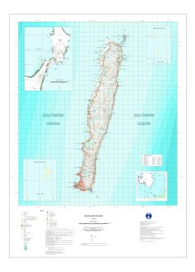
Map 12707: Macquarie Island, Tasmania
Map details
| Map Number | 12707 |
| Title | Macquarie Island, Tasmania |
| Edition | 2 (Out of Date) |
| Previous edition | [Previous edition : 1] |
| Next Edition | [Next Edition : 3] |
| Scale | 1 : 50 000 |
| Publication date | June 2001 |
| Publisher |
Australian Antarctic Division (Australia)
|
| Spatial coverage |
(158.5830° -54.3500°)
,
(159.1160° -54.3500°)
,
(159.1160° -55.1250°)
(158.5830° -55.1250°) |
| Projection | Universal Transverse Mercator |
| Physical size | 100 x 73 cm A0 |
| Notes | single sided |
| Keywords | Macquarie , Island , TASMAnia , Wireless , West , Bauer , Bay , Hut , Nuggets , Boiler , Rocks , Brothers , Aurora , Eitel , Green , Gorge , Law , Waterfall , Tiobunga , Rockhopper , Lusitania , Precarious , Windy , Ridge , Star , Hurd , Caroline , Bishop , Clerk , Topographic |
Downloads
This is a digital map available for downloading.
Map Lists
No maps lists available.
Additional Information
| Horizontal datum | WGS84 |
| Vertical datum | MSL |
| Nomenclature | Nomenclature Board of Tasmania. |
Preview