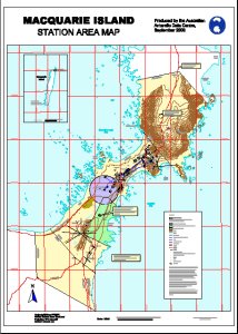
Map 12710: Macquarie Island Station Area Map
Map details
| Map Number | 12710 |
| Title | Macquarie Island Station Area Map |
| Edition | 4 |
| Previous edition | [Previous edition : 3] |
| Scale | 1 : 2000 |
| Publication date | September 2000 |
| Publisher |
Australian Antarctic Division (Australia)
|
| Spatial coverage |
(158.9222° -54.4889°)
,
(158.9500° -54.4889°)
,
(158.9500° -54.5083°)
(158.9222° -54.5083°) |
| Projection | Universal Transverse Mercator |
| Physical size | 119 x 85 cm |
| Notes |
This map is out of date. See Macquarie Island map list for a current map of Macquarie Island station. |
| Keywords | Macquarie Island Station Area , Hasselborough Bay , Buckles Bay , Landing Beach |
Downloads
This is a digital map available for downloading.
Map Lists
No maps lists available.
Additional Information
Preview